After Light Snow, Sleet Hit Massachusetts, Wintry Mix Will Taper Off Sunday Morning
BOSTON (CBS) – A sloppy, ugly system will continue to slowly grind its way across Massachusetts overnight before finally tapering off in the morning. Snow came in even lower than expected, with a quick switch to sleet for many areas on Saturday.
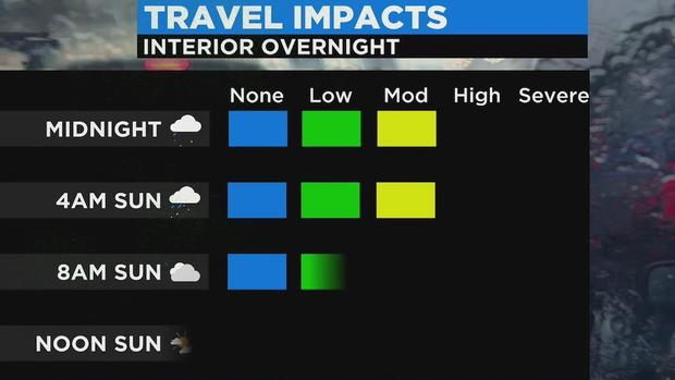
A mix of ice and rain will remain, making for spots of slick travel until early Sunday for areas northwest of Worcester and the 495 corridor.
Temperatures will remain near freezing for those interior spots with a mix of freezing rain and sleet for northern Worcester County and into much of southern New Hampshire.
Anyone heading out should remain cautious on the roads. To the south and east, temperatures remain above freezing through Sunday morning with only wet roads expected.
The second half of the weekend starts out with clouds and a couple lingering rain/snow showers. Skies will begin to clear out across central Mass by mid-morning, and then gradually continue to brighten toward the coastline heading toward midday.
The only spot that may not clear out at all on Sunday is Cape Cod and the Islands, with temperatures hovering in the 40s.
With a busy week ahead, the weather looks largely cooperative with generally dry and seasonable weather. It looks like the only chance of precipitation will be for some rain Wednesday afternoon as a storm system glides by to the southeast. Otherwise, stress free for travel and last-minute holiday errands!
A White Christmas cannot be completely ruled out, with a small chance of a weak system in the area on Christmas Day. But at this time, it looks quite unlikely for most of southern New England.