Clipper system could bring 6" of snow to parts of Massachusetts
By Meteorologist Dan Brown, WBZ-TV
Though hopes for a decent white Christmas in the Boston area were dashed, we now have a renewed chance of getting some fresh powder on the ground Friday night into Saturday morning. Moreso, parts of Massachusetts could be in store for plowable snow.
The WBZ weather team is issuing a Next Weather Alert for incoming snow showers through early Saturday morning.
Fast-moving clipper system
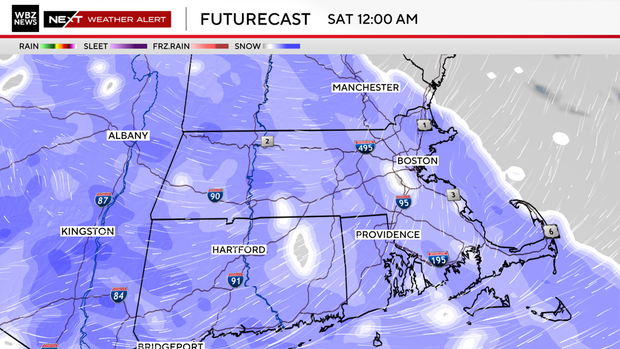
We continue to track a fast-moving clipper system that will bring us a punch of snow.
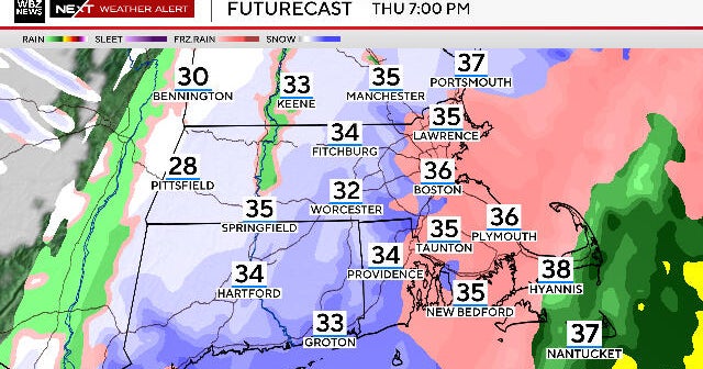
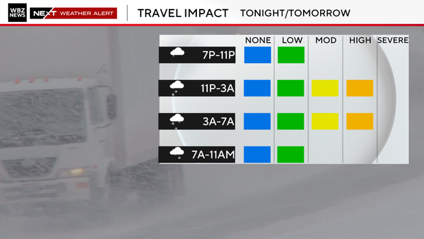
Snow will over spread the area from west to east between 9 p.m. and midnight. It's a fast mover so it will be out early Saturday morning but not before a fresh blanket of snow across all of southern New England.
How much snow?
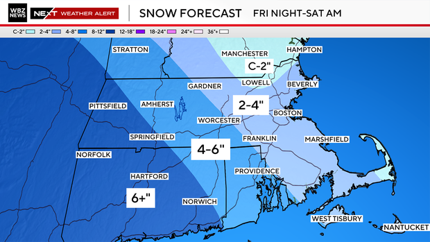
With plenty of cold air in place, snow will be light and fluffy which is easy to move around but will also pile up quickly.
Snow may briefly come down at a good clip overnight especially across Worcester County and points west where over 6" of snow is possible.
There may also be a bit more along the shoreline south of Boston thanks to a moist fetch off the Atlantic. Most will pick up 2-4" of snow with lower amounts across the Merrimack River Valley and into southern New Hampshire.
Snow winds down early Saturday with some sunshine for the second half of the day. It will be cold and blustery with temperatures in the upper 20s. Be sure to bundle up and grab the sunglasses with lots of solar glare. It will make for a pretty day.
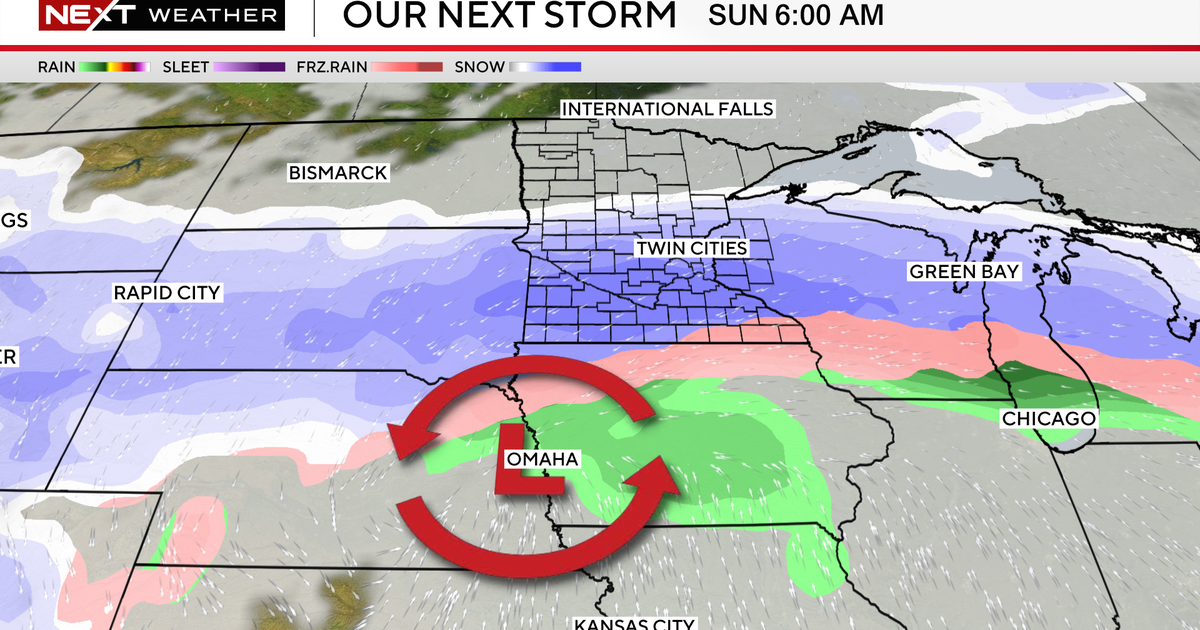
With a clear sky, diminishing breeze and fresh snowpack, temperatures will plummet into the single digits and teens, but we should warm up quite a bit on Sunday with highs in the 30s to near 40 ahead of our next storm system. But this time around it will be mostly rain.
Next storm Sunday
The onset of our next storm may start as sleet and or freezing rain mainly outside of 495 Sunday night but even in the Boston area it will change to rain as southerly winds take hold.

Monday will be rainy and mild with gusty southerly breezes. Temperatures will top off near 50 before a cold front comes through during the evening bringing in drier, colder air to close out 2025.