It ain't over till it's over!
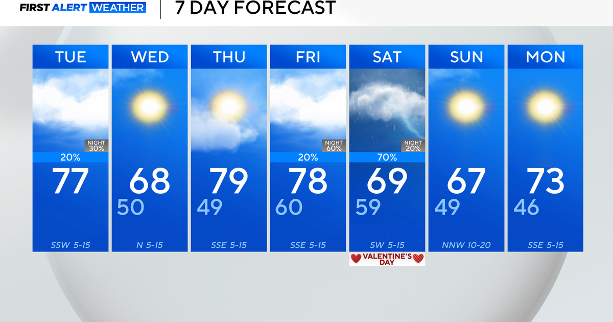
I don't know about you, but summer doesn't seem to last quite long enough around here. The good news is even with students heading back to school and pumpkin ales on the shelves, fall doesn't seem to be in too big of a rush just yet. In fact, every day on our 7-day forecast features highs above average! (The avg high is 78 right now, 77 by this weekend)
In terms of rain, it will be hit or miss (mainly miss) over the next two days. While an ocean low spins off the coast, enough instability will be generated across the interior to spark afternoon thunderstorms on both Wednesday and Thursday. Any that do develop should stay below severe limits, although with plenty of moisture in the atmosphere they could dump some very heavy rainfall.
As we head toward the holiday weekend, the weather is looking warm and muggy. Most models are trending the *big* warmth staying to our west, under a sprawling area of high pressure that can easily be spotted on water vapor imagery: Eastern U.S. Water Vapor loop
We'll still manage the 80s, the question is whether or not it stays dry. Right now I'm thinking yes, with maybe a pop storm or two here and there (especially Sunday). By Labor Day Monday heights in the atmosphere will be falling as a cold front rolls down from Canada. The timing is still being worked out, but it may bring some thunderstorms to end the holiday weekend. In any case, it should certainly deliver some cooler temps and a refreshing air mass, which should start to filter down by Tuesday.
On the National front, wildfires continue to rage in California. The 'Rim Fire' is the largest fire ever recorded in the Sierra Nevada region of California, with over 160,000 acres burned. Over 3,700 firefighters are involved in the fight. The main culprit? Dry weather. As you can see, California has seen its driest Jan-July ever recorded. This is mainly due to lack of snowfall (or rain) during the past winter.
Here's a time-lapse camera of the fire on Tuesday. What you see happening at about :30 seconds in is mixing of the atmosphere increasing as the day wears on. The low-level inversion, which put a 'lid' on the fire for the morning hours, mixed out. And what happens next looks like a bomb went off: Rim Fire Time Lapse
Higher humidity ahead may help firefighters gain more control. As of this writing, the fire was listed as 20% contained. Even with the huge blaze, most of Yosemite National Park is still open and visitors are welcome.


