Significant icing, plowable snow possible in parts of Massachusetts into Friday, weather maps show
The active weather pattern in the Boston area continues. We are issuing yet another NEXT Weather Alert for a very messy night Thursday with a variety of precipitation types and weather-related hazards in play.
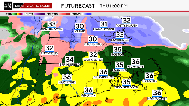
Variety of precipitation types
We expect conditions to go downhill hour by hour after dark and travel will become quite treacherous in many areas.
The precipitation will start as a mixture of rain and sleet across southern New England.
Throughout the overnight hours, we will settle into mainly rain south of the Mass Pike and a mix of sleet, freezing rain and snow to the north.
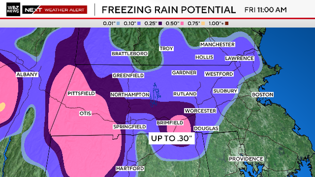
Ice accretion concerns
Untreated roadways will quickly become slick and treacherous north of the Pike.
Our greatest concern for ice accretion (freezing rain) is in southern Worcester County and in Western Massachusetts and Connecticut, where up to .25" or more will accrete on power lines, trees and any untreated surfaces around your home.
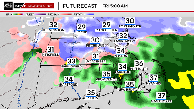
After midnight, temperatures will cool just enough for the sleet to change over to snow across northern portions of Worcester, Middlesex and Essex counties as well as southern New Hampshire.
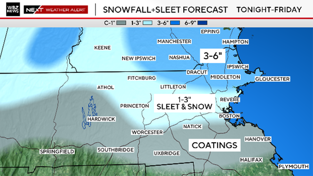
How much snow from the storm?
Snow could fall quite heavily at times around and just before dawn before tapering off after 7 a.m.
We are forecasting 3-6" of snow in northern Middlesex County and most of Essex County and southeastern New Hampshire.
There will be 1-3" of sleet and snow in Worcester County, southern Middlesex County and Suffolk County.
Just to the south of the Pike, only some scattered coatings of sleet.
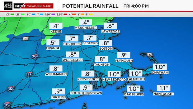
Flooding concerns
We are also concerned about pockets of localized flooding across southeastern Massachusetts, where most of the precipitation will fall as rain.
We expect between 1-1.5" of rain over this area which, of course, still has a very extensive snowpack.
Warmer weather ahead
Once we get past this event, the weather story will shift towards warmth and melting.
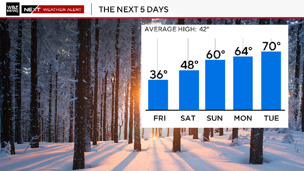
Next week will certainly be a shock to the system with highs between 60-70 degrees Sunday through at least Tuesday. With temperatures like that and a much higher sun angle, just about all of the snow cover should be gone by this time next week.