Flood watch issued in Massachusetts as weather forecast maps show heavy rain potential Tuesday
There is a flood watch in parts of Massachusetts, following the hottest start to July in Boston's recorded history. The weather forecast calls for a break from the heat, and introduces something that has been severely lacking across many communities in southern New England - rain.
Boston is about 10" below the average precipitation date for 2026. Eastern Mass. is currently blanketed in a "severe drought."
So far this has been the driest start to any recorded year in Boston. Each and every month has been below average.
So clearly, we could use some water.
The current atmospheric setup is not one that we would typically expect to see in mid-summer. Over the next few days, there will be an area of low pressure passing just to our south. Waves of rain will pinwheel into our area along with some gusty northeast winds along the coastline, reminiscent of a winter or springtime storm system.
Flood watch Massachusetts
The WBZ Weather Team has issued a NEXT Weather Alert through Tuesday for the potential of some heavy, excessive rainfall.
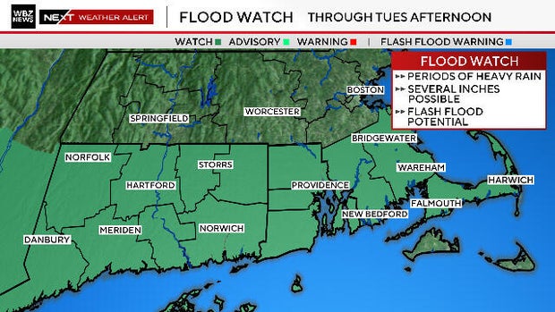
In addition, the National Weather Service has issued a Flood Watch for areas south of the Mass Pike for the risk of flash flooding of small creeks and streams through Tuesday. There is potential for some locally heavy bands of rain to develop Monday night and early on Tuesday which could drop several inches of rain in a short amount of time.
Finally, the Weather Prediction Center has placed areas along and south of the Mass Pike in a slight to moderate risk of excessive (heavy) rainfall in the next 24 hours.
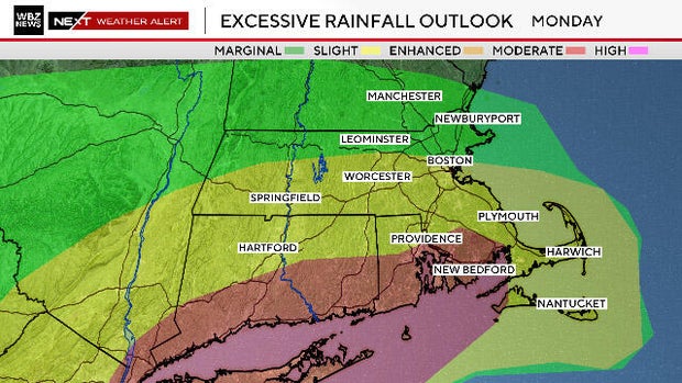
Weather models are struggling a bit with where to place the heaviest rainfall. Some keep it offshore while others pivot the downpours over eastern and southeastern Mass.
Torrential downpours, gusty wind
We have determined that the risk of torrential downpours is high enough to warrant an alert and would advise that you stay tuned to updated forecasts. Tuesday morning's commute could be severely impacted in some areas.
Northeast winds will get gusty for several hours on Tuesday, especially along the immediate coastline. Wind speeds would reach as high as 20-40 mph, creating the potential for some isolated tree damage.
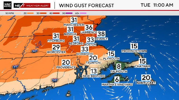
The rain and winds will begin to taper and relax by Tuesday evening. From there, we get back to summer business with highs nearing 90 once again by later this week.


