Line Of Thunderstorms Will Bring Heavy Rain, Gusty Winds Wednesday Evening
BOSTON (CBS) -- Leave it to New England to go from a wintry scene to thunderstorms within just a few days! Today's threat is relatively short lived, but can still pack a punch at the wrong time.
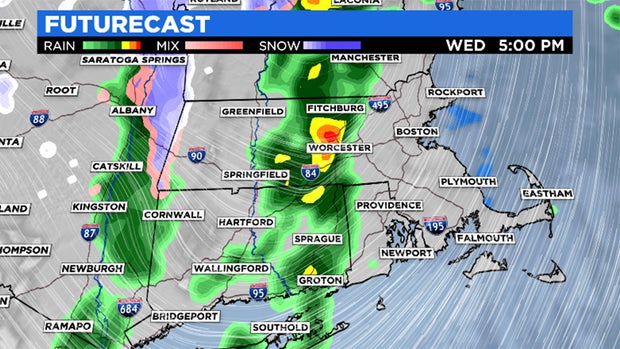
TIMING: The defined line of storms associated with the cold front will roll through the Berkshires near 3 p.m. By 4-5 p.m., Worcester County will be dealing with the heavy rain and gusty winds. Add an additional 45 minutes to an hour for 495 and anyone east to tap into the storms.
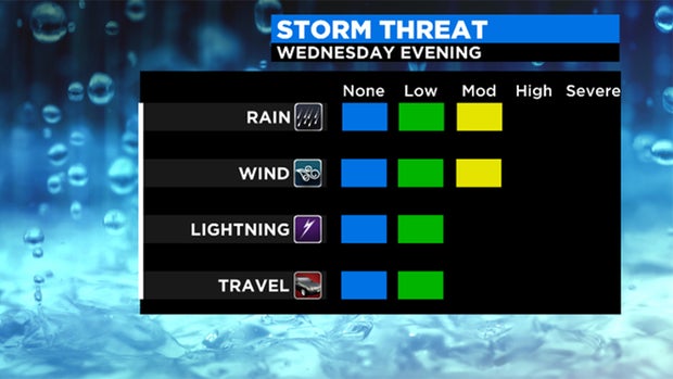
WIND: This is likely the main threat with this sweeping system. Gusts of 30-40 mph can bring down limbs and branches. Power outages are also possible. These gusts are "straight-line" meaning the threat for rotation or a tornado is not expected.
RAIN: Moderate to heavy downpours are likely throughout the duration of this event. While the intensity is there, rain totals will only reach 0.25-0.5". Main impact will be lower visibility and wet roadways through the evening commute.
On the back side of this system, cold air funnels in. Wind gusts will likely exceed 40 mph on Thursday morning making it very chilly.
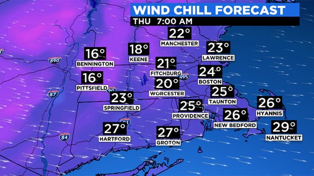
It will feel like the 20s early Thursday and wind chill values remain in the 30s in the afternoon.