Winds Could Cause Additional Damage Thursday
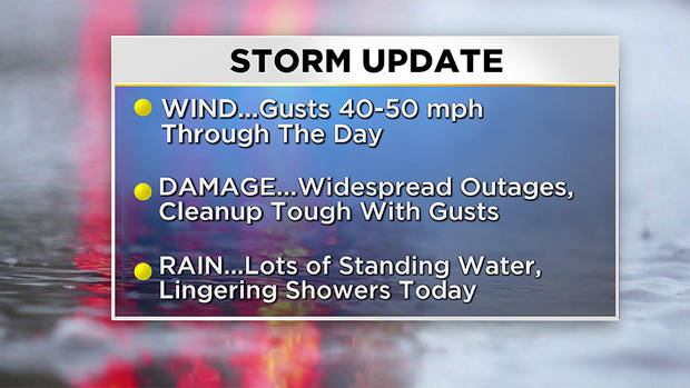
BOSTON (CBS) - Wow – what a wild night! Peak wind gusts across southern New England topped out between 80-90 miles per hour in spots, resulting in widespread damage and power outages across the region.
Leave extra time to get to your destination Thursday morning as a number of hazards, including downed limbs, power lines and wet leaves will slow you down.
The core of the strongest wind is now shifting across the Maine coast, as our rapidly intensifying storm moves northward. While gusts won't be as extreme today, there will still be the threat for damage. On the backside of this system, the wind has now shifted to the southwest and gusts will still range between 40-50 mph through the early evening.
In terms of rain, it is a day you'll want the raincoat. We're in the dry slot of the storm right now, but wrap around moisture will cause pockets of rain to redevelop from midday through the early evening.
Friday features improvement as breaks of sun come out and the wind will no longer be damaging. And the weekend? Still looking awesome! Expect sunshine and highs in the lower to middle 60's.
Photo Gallery: October 17 Storm Damage
As always we urge that you stay tuned to WBZ-TV, CBSBoston.com and CBSN Boston for frequent updates.

