1 More Warm Day
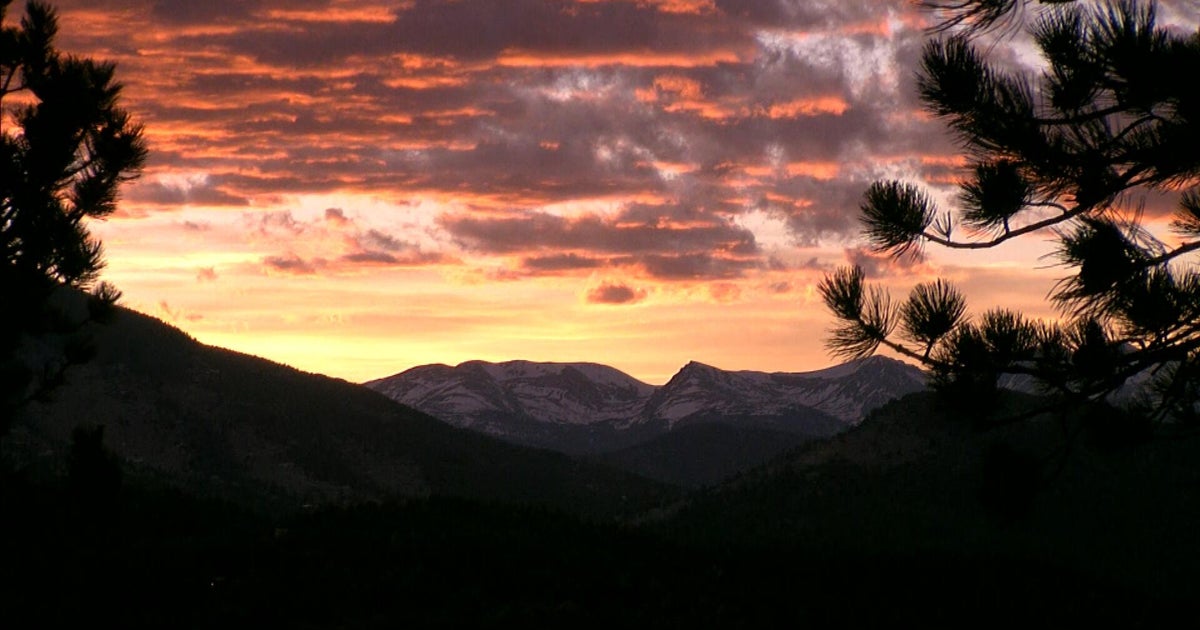
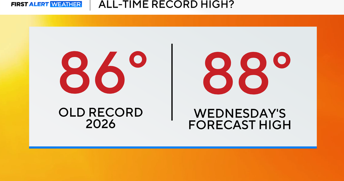
It almost seems like we skipped winter and summer is beginning again. Wouldn't that make a lot of happy people? Did you love today or what? Boston's max of 87 degrees smashed the previous record of 82 set in 1942. Many new record high temperatures were established across the Northeast. Here is a partial official list: Boston 87, Providence 86, Hartford 85, Concord NH 85, Portland 85, Burlington VT 80, Kennedy NY 87, Islip NY 85, Newark NJ 88. It was the climax of this 3-day stretch. The core of the warmth is now exiting but it will only be slightly cooler tomorrow with temperatures down about 3-5 degrees. Hopefully, you have the holiday off to enjoy another splendid day. I must reiterate that the chance is slim to none that most of us will ever see another Columbus Day Weekend like this one again. Seriously! The combination of 3 consecutive brilliantly sunny days with highs of 78-87 plus low humidity, a pleasant summery breeze and refreshingly cool nights occurring on this particular 3-day holiday weekend in October over the entire New England region is just like winning the biggest mega-millions jackpot ever. Think about it. It's a one-time shot so get out and enjoy it to the max. It seems a bit strange being at the beach in early October but that's what many folks were doing today. My wife and I enjoyed a wonderful walk on the beach yesterday and I followed that up with a terrific bike ride along the NH coast on Route 1A. Sweet! Today, I couldn't resist my son's invitation to go climb another mountain over 4,000 ft. With the absence of clouds, it would have been a perfect day to ascend any of the Presidentials over 5000 ft especially Mount Washington at 6288 ft. However, due to my work schedule this evening, I only had time to ascend the Kinsman Ridge Trail on Cannon Mt. in Franconia Notch, NH. I loved it. The views from the summit took my breath away. It was so great to see so many people out there enjoying this special day. There was plentiful hiker traffic on the trails for sure.
This discussion leads me to expound on the fall foliage situation again having observed the progress of the color wave first hand today from what I saw last weekend at Bretton Woods. It appears that the peak color zone right now is in and just above the upper portions of Franconia Notch, Crawford Notch and Pinkham Notch. The northern White Mountains have become very colorful but it is not as stunning and vibrant as last year. There is moderate color showing up in the southern White Mts extending over into the Western Mountains of ME and westward to the Green Mts. Splashes of color are becoming more noticeable in places as far south as the Worcester Hills while other areas have virtually no color at all. It's fickle and appears to be a solid 10 days behind schedule. As expressed in my blog last evening, there are several factors that are influencing the magnitude of this year's color across the area. The winter moth infestation resulted in defoliation and, in some cases, only partial refoliation followed. Irene's winds damaged leaves on trees facing the south and southeast. Additionally, salt spray tainted leaves of many trees near the coast especially the South Coast and Cape Cod. A wet month of May promoted the growth of two types of fungus which flourished during the dry, hot July. Insufficient rainfall during a portion of the summer lead to a wet and humid stretch later in August and September which is detrimental to bright fall colors. Add in the far below average number of frosty cold nights and bright sunny days in September and early October and you have a recipe for disappointing fall color. The chilly nights at the end of last week did pop some color and it will be beautiful from place to place going forward but I suspect that it will not be widepread stunningly vibrant color. Expect more muted and tarnished hues.
Finally, my concluding paragraph will reveal the weather changes that I expect over the next 5-7 days. After tomorrow's bright sunshine and lower 80s with no new record highs, a weak cold front will back into the area tomorrow night introducing a wind shift to the northeast and east for Tuesday. Consequently, it will be much cooler along the coast with highs near 66-68 with lower to middle 70s farther inland as more feathery cloudiness appears. This high cloudiness will be thickening enabling only a dim sunshine on Wednesday. The strong ridge of high pressure that has created our remarkable holiday weekend will shift offshore enabling a type of subtropical low pressure system to chug northward along the eastern seaboard. Its rain shield will arrive late Wednesday night. It remains indeterminate just how heavy this rainfall might be on Thursday but, right now, it seems that 1-2 inches is a reasonable prediction. After that, a digging short wave will sharpen the upper air trough and pass across the area Friday afternoon with a period of healthy showers and boomers. Once this exits, a brisk southwesterly wind will blow during next weekend with sunshine yielding to passing patches of clouds at times. There could be a couple of brief showers late Saturday and again about next Sunday evening especially farther north and west of Boston.
Melissa Mack delivers here AccuWeather Forecast in the morning and I shall return later in the afternoon for Todd Gutner.
Have an enjoyable Columbus Day.