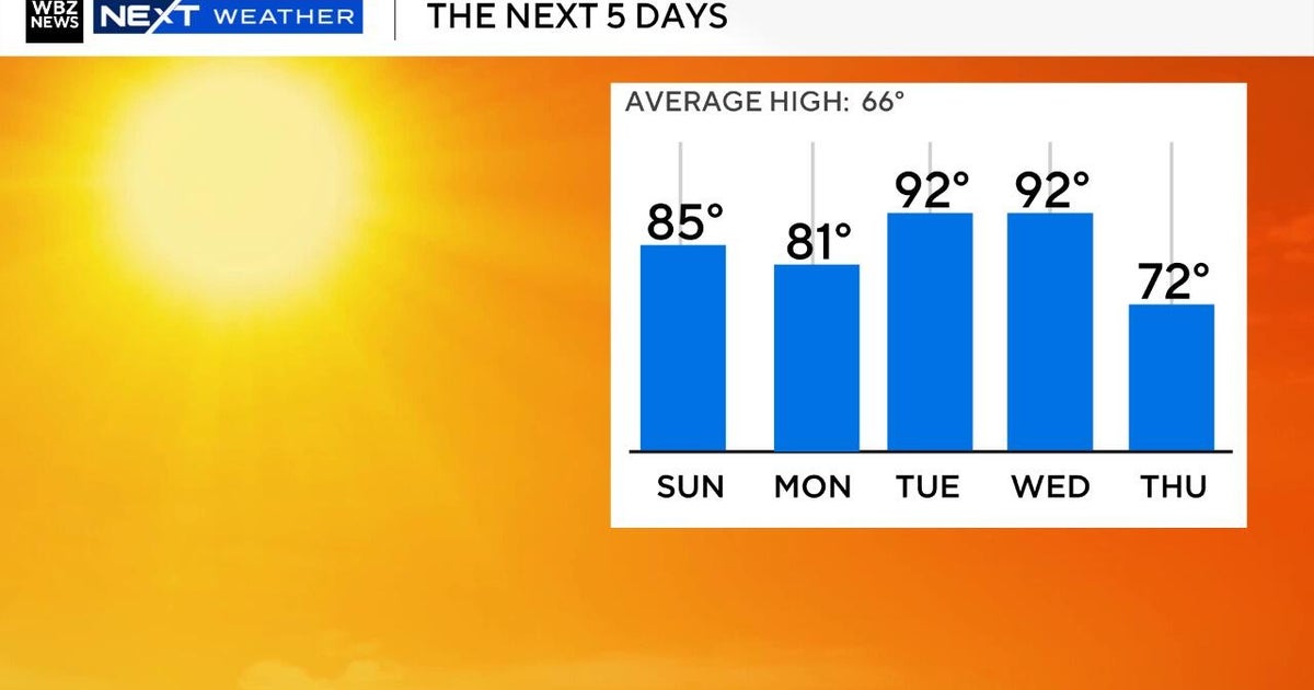
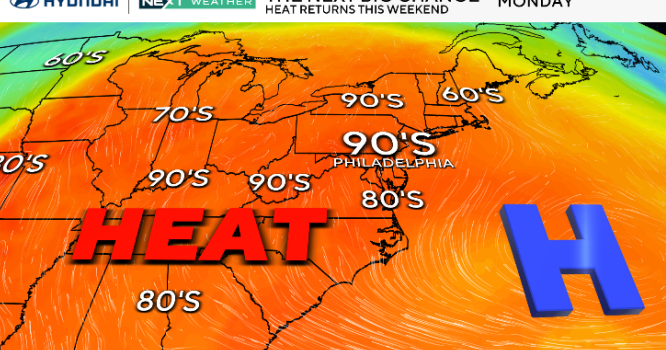
Unsettled weather returns to Maryland this week

The First Alert Forecast remains dry for any Memorial Day evening plans.
It won't be as cool tonight, thanks to increasing clouds. It'll feel pleasant outside through the evening. Plan on temperatures gradually cooling through the 60s after sunset.
Tuesday begins with temperatures in the mid to upper 50s. This is several degrees warmer than the past few mornings and closer to average for the time of year. The sky will already be mostly cloudy early Tuesday morning as the next storm system approaches the DMV.
A stretch of unsettled weather begins late Tuesday...
A sprawling storm system will bring widespread wet weather to Maryland this week. Spotty light rain builds into greater Baltimore Tuesday evening. Rain becomes widespread and steady Tuesday night, into Wednesday morning. Plan on dreary weather Wednesday. The mid-week forecast includes periods of rain, a cloudy sky and temperatures stuck in the 60s Wednesday. Spotty heavy rain and thunder are possible in southern Maryland. A breeze will add to the cool feel through the day.
Clouds linger into Thursday as temperatures warm back into the 70s. Isolated, to scattered, showers and storms are expected Thursday; especially during the afternoon and evening. While rain won't be as widespread as Wednesday, what storms do develop could produce brief heavy rain. Additional showers and a few storms are expected Friday, into Saturday.
There is still some uncertainty in the exact timing of late-week rain. The WJZ First Alert Weather Team will be fine-tuning the forecast through the week. You can get updates on WJZ, streaming on CBS News Baltimore and in the CBS News App.