Hurricane Isaias' path may impact Maryland this weekend. Here's what to know.
Hurricane Isaias, now a category 2 storm, remains on a path to make landfall along the U.S. Gulf Coast later this week, and the remnants of the storm could make for rainy conditions across Maryland.
Isaias strengthened from a tropical storm late Wednesday night and became the first hurricane of the 2026 Atlantic hurricane season early Thursday morning.
The northern Gulf Coast is now under a hurricane warning from the Mississippi-Alabama border, across southern Alabama to Panama City, Florida.
Tracking Hurricane Isaias' path
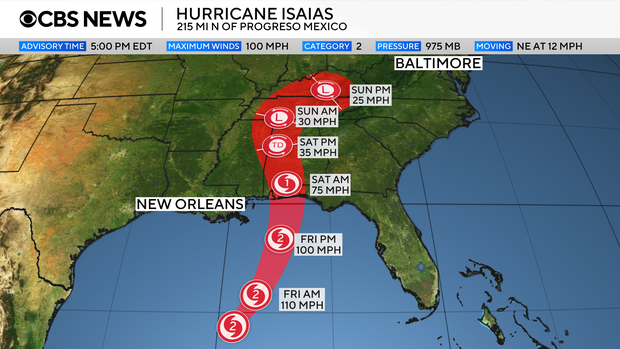
CBS News Baltimore's First Alert Weather Team reports Isaias is expected to make landfall somewhere between the Mississippi coastline and the western Florida panhandle early Saturday morning.
Once onshore, the storm will weaken quickly, but it will also expand in size as it moves north and its forward-motion accelerates.
By the time any impacts are felt in Maryland, the system will no longer be a hurricane or a tropical storm.
How will Hurricane Isaias impact Maryland?
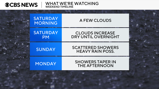
Saturday looks to be the pick of the weekend in Maryland. Highs will top out in the lower 70s, with a dry forecast.
The remnants of Isaias will start to impact the area Saturday night and continue through Sunday, which is a possible First Alert Weather Day.
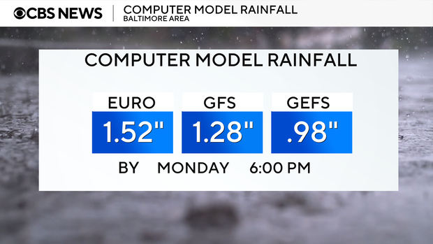
Early estimates indicate most of central and eastern Maryland will receive anywhere between 0.5 and 1.5 inches of rain from the storm. Any flooding should be minor and/or isolated.
While outdoor plans may be a washout Sunday, the rainfall is not expected to benefit the state's ongoing drought situation. The ground will likely absorb that amount of rain like a sponge.
Monday morning will start showery, but it will dry out during the afternoon and evening as the storm departs.