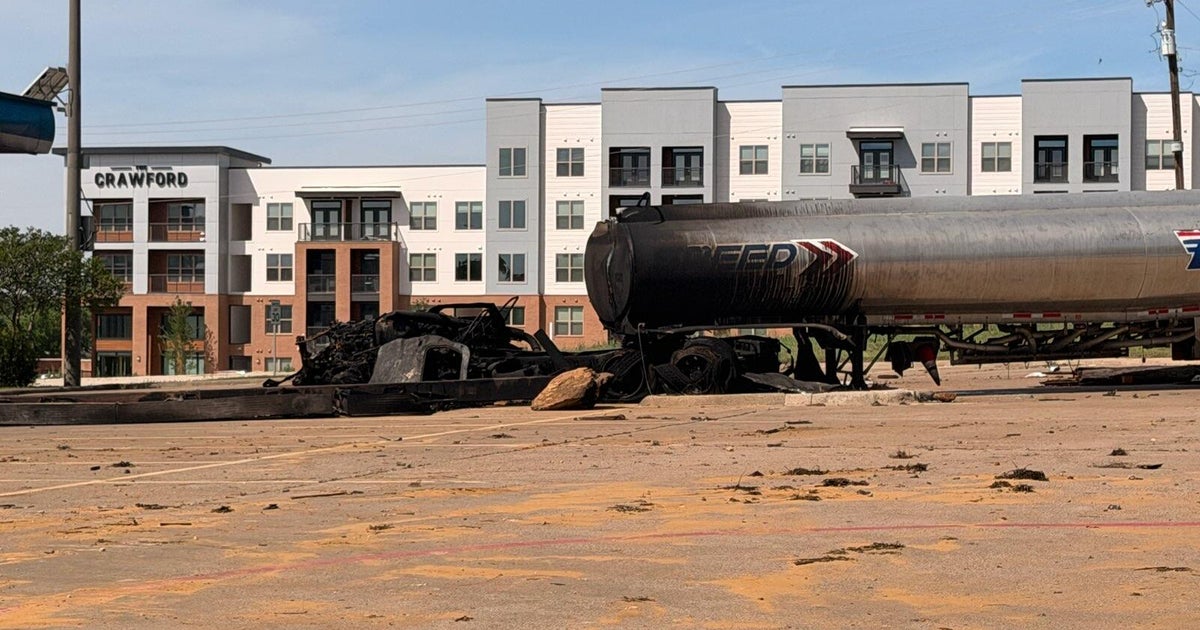
Next Round Of Winter Weather Hits Tuesday Afternoon, Expect Significant Ice Threat
NORTH TEXAS (CBSDFW.COM) - Along with the record-breaking cold we're experiencing this Tuesday, our next round of winter weather is set to arrive starting this afternoon and ramp up tonight. Expect hazardous travel conditions Tuesday night into Wednesday.
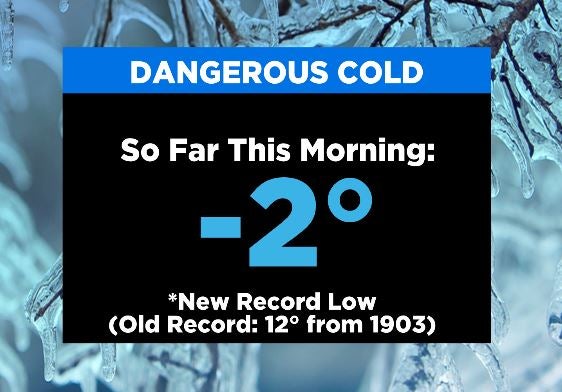
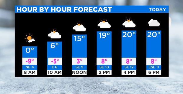
We've already broken the previous record low this morning of 12°, set back in 1903, when we had the temperature at DFW airport drop to -2°. And highs this afternoon will struggle to get out of the teens. Clouds will also be on the increase this afternoon ahead of our next winter weather event, expected to start Tuesday afternoon and continue through Wednesday.
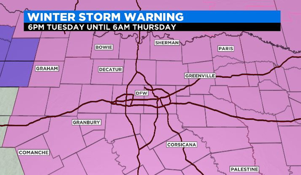
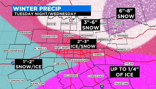
A Winter Storm Warning will go into effect at 6 PM Tuesday and continue through 6 AM Thursday. We're expecting snow, sleet AND ice to accumulate across parts of North and Central Texas. This event will be different than what we experienced Sunday into Monday, specifically because of the significant ice threat.
Snow totals will range from 1"-4" generally across North Texas, with higher amounts expected the farther north you are. The ice threat begins in the metroplex where accumulations up to 0.1" are expected on top of the snow, and the ice threat increases the farther south you go, especially south of I-20 where up to 0.25" of ice are expected on top of any snow.
The ice is expected to exacerbate the infrastructure issues we're dealing with, so prepare for power outages to continue. The ice will also make traveling dangerous Tuesday night through Wednesday. Conditions will improve into Thursday, but temperatures aren't expected to warm back above freezing until Friday afternoon.