Winter Weather Advisory In Effect For DFW Metroplex And Beyond From Early Saturday Morning To Midday
FORT WORTH (CBSDFW.COM) - A Winter Weather Advisory has been issued for 4:00 a.m. Saturday, Feb. 26, until noon for parts of North Texas including the Metroplex.
Therefore CBS 11 Meteorologists have made it a First Alert Weather Day until noon.
I know we are all feeling winter storm fatigue and seeing a new advisory adds another layer of exhaustion.
This won't be a long-lasting event so there isn't a need to run to buy bread and milk.
I still have my big box of Lucky Charms, but it hasn't provided any luck to change our weather pattern.
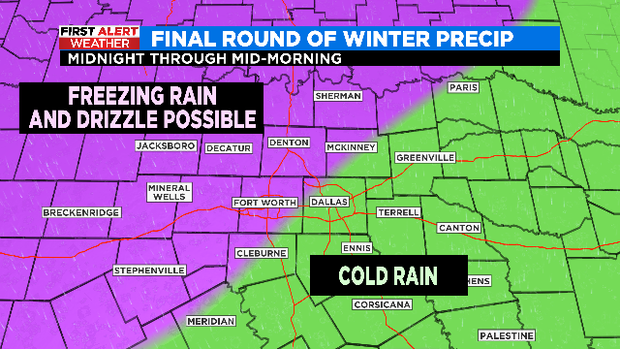
The advisory does include the DFW Metroplex and our counties west and southwest.
- We have moisture streaming into NTX from the SW.
- This is riding up and over the colder airmass we have in place. That's called isentropic lift.
- We are already seeing some spotty light rain in parts of NTX Friday night.
- After midnight as the temperatures drop closer to the 32° mark we could see some spotty freezing rain or drizzle develop.
- The threat is to have a thin glaze or potentially 0.01-0.02" of ice accumulate mainly on bridges and overpasses.
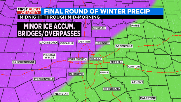
- The main roads should be fine thanks to the sunshine we saw Friday.
- Some sidewalks and low traveled secondary roads may get a bit slick, but I don't anticipate a lot of travel issues.
- Temperatures will warm enough by our late morning hours for any mix of freezing rain and drizzle to switch to mainly a cold rain .
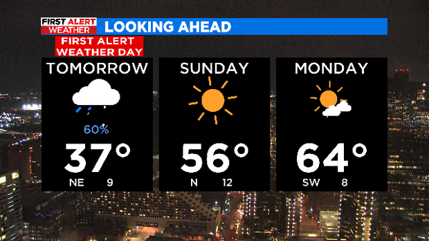
Temps warm to 37 for a high Saturday. Then we are warmer Sunday and through next week. Hang on just one more day (Cue Wilson Phillips) and then we are thawing and in a quiet pattern.