Winter Storm Watch Issued For North Texas
Follow CBSDFW.COM: Facebook | Twitter
The weather is forecast to turn icy by late this weekend into early next week.
A WINTER STORM WATCH has been issued for parts of North Texas, including the DFW Metroplex Sunday evening through Monday.
A WINTER STORM WATCH is issued when freezing rain is forecast to accumulate to 1/4" or more and/or sleet accumulates to 1/2" or more in the next 12 to 36 hours.
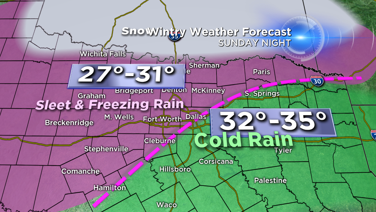
The CBS11 Storm Team expects most of Saturday to be dry and into Sunday, even as a cold front moves in Saturday morning. By Sunday evening, an upper level disturbance will move across the area and produce scattered rain. As temps fall below freezing Sunday night, rain will become freezing rain and also mix with sleet.
Sleet and freezing rain will continue off and on throughout the day Monday, with temperatures never getting above freezing. The predominant form of precipitation in the Metroplex is forecast to be sleet. There will be accumulating ice on the bridges and overpasses, along with secondary roadways. There is also a potential for scattered power outages where ice coats tree branches and power lines.
There will likely be icy spots on area roadways through Tuesday morning before a slow improvement during the day Tuesday.
(©2015 CBS Local Media, a division of CBS Radio Inc. All Rights Reserved. This material may not be published, broadcast, rewritten, or redistributed.)


