Windy, Hot With Rain on the Way
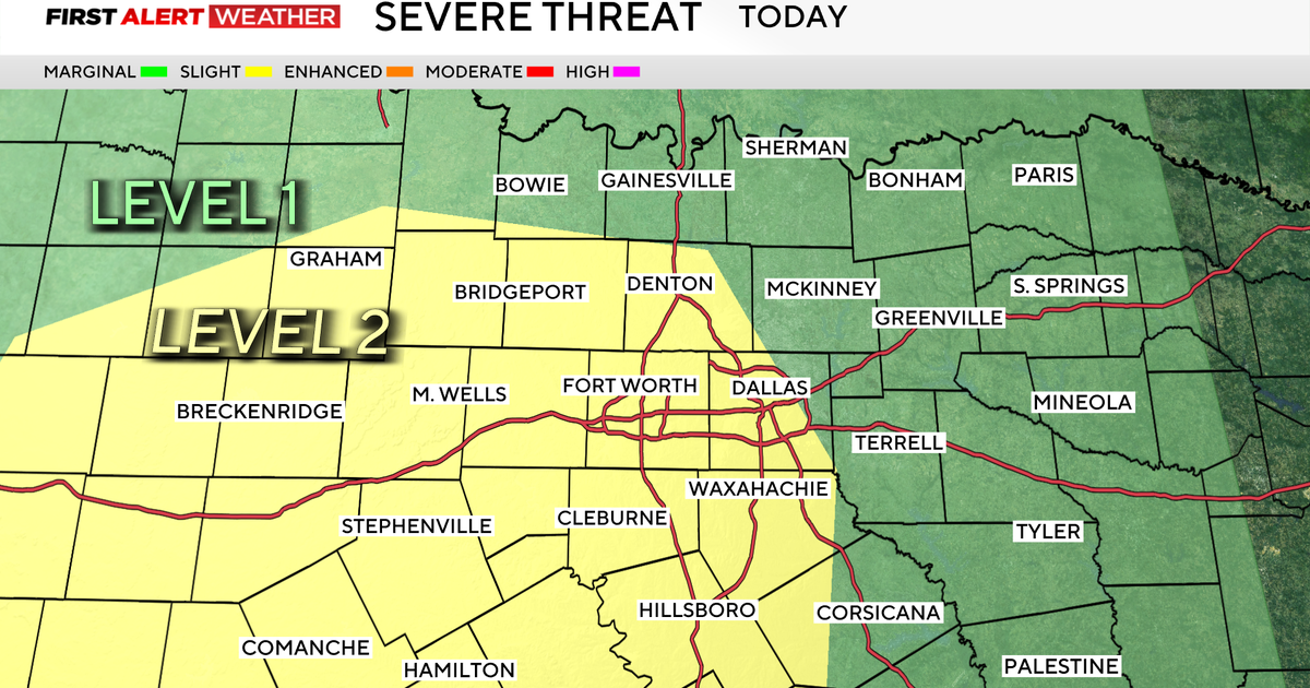
Storms will develop along the dryline to our west this afternoon and evening. These storms will get into our west and northwest counties. Draw a line from Cooke county down to Earth county; from there to the west is where we expect some strong storms; downburst winds, hail and lightning will be the main threat.
High fire danger again today, wind gusts will hit around 40mph and hold steady from the south at 23-30mph. We've only recorded a trace of rain since we started June; drought conditions, highs above 100 degrees and these strong winds have really dried out the grass and brush. Red Flag Warning for our area combined with a wind advisory. Highs today should hit close to 100° again at DFW, we've now logged 7 days in a row of triple digit highs, the highest number of 100-plus days in the last 13 Junes' at DFW.
Tomorrow a cold front moves in and gives us much-needed chance of widespread rain. We'll have a few showers around in the morning hours tomorrow in our northern half (including the metro) but most of the rain will come in the afternoon hours. There is a risk of severe weather Tuesday in these afternoon/early evening storms.The SPC puts north Texas in a "slight risk" category:
The rain will continue into the night and into Wednesday morning before moving to our southeast counties. Some areas could get 1"-2" inches of rain by the end of the day on Wednesday with the greater amounts east and southeast of the metroplex. Here is the rain total forecast by the HPC:
The rain and clouds will drop the temperatures a little; highs tomorrow in the mid-90's and in the low 90's on Wednesday. This "cool spell" only lasts a couple of days. We expect we'll get right back to the upper 90's by Thursday and this coming weekend.