Weekend cold front before triple digits return next week

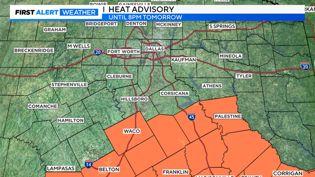
NORTH TEXAS (CBSNewsTexas.com) - There is a Heat Advisory for our southern tier of counties Saturday until 8 p.m. Elsewhere, no advisories are posted for Saturday.
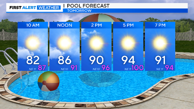
A weak cold front slips over North Texas tomorrow morning. There is a very small chance for some rain as the front brings cooler temperatures and lower humidity for most of north Texas
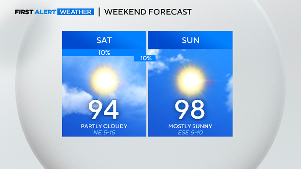
A cold front moves through most of North Texas Saturday to start the weekend. It won't arrive soon enough across our southern counties to keep the heat at bay.
For the rest of the Metroplex, we finally get a day without a Heat Alert of some kind.
There was another triple-digit high at DFW Fridayday but "only" in the mid-90s Saturday.
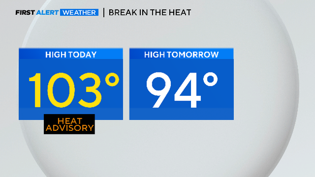
This is a welcome break from the heat. Try your best to enjoy it because it is likely the coolest day for the rest of the month.
With this rare cold front coming through Saturday morning, there is a very small chance for some rain in your yard. But this 10% chance of rain is just a blip in the run of very dry weather so far this summer (driest start at DFW since 1980).
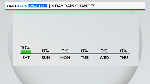
Here is the 7-day outlook for rain. You can see a circle of nothing around North Texas.
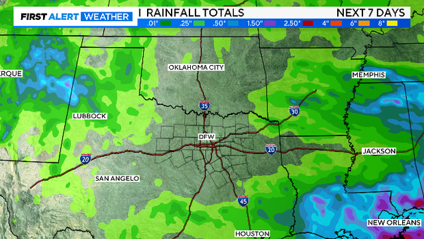
Our current deficit of rain started in Spring. Ever since March, every month has recorded below-average rainfall. Drought is starting to take hold in parts of North Texas.
Sunday will be another day below 100, a nice end to what was the hottest work week we've had so far this season. The two hottest days of the summer so far happened on Monday and Tuesday of this week.
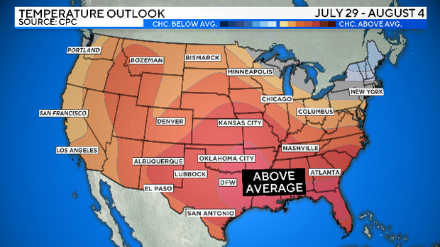
It appears that starting Monday and continuing into early August, 100-degree days are in the forecast. We normally get about 20 of these every summer, we'll surpass that number by mid-week next week.
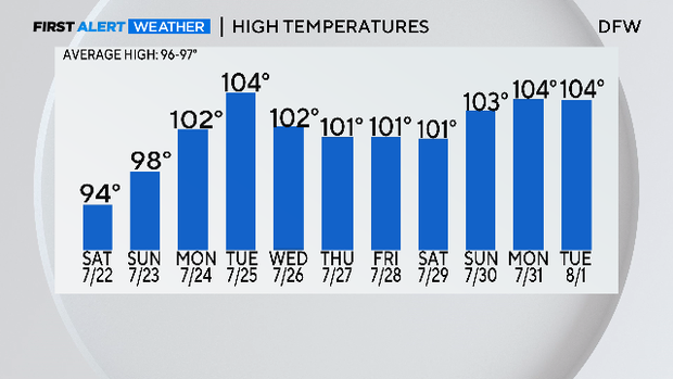
As we look into early August, there is no indication yet that the heat wave over most of the United States is going to back off.