Weather Forecast Update: Windy Days Ahead And Near Record Heat
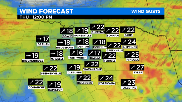
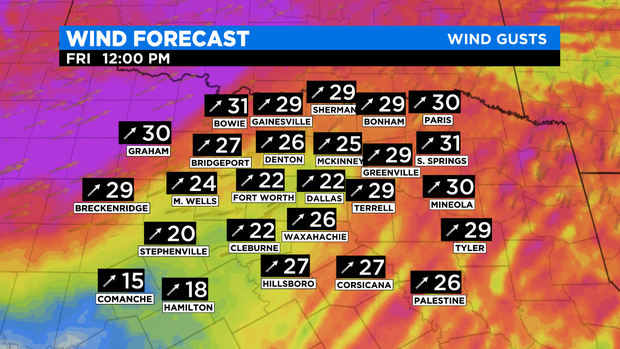
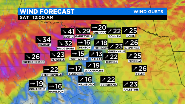
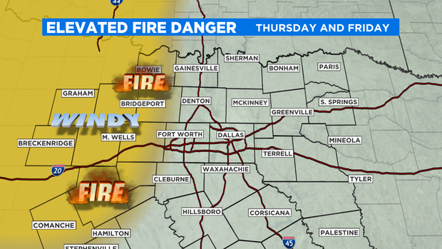
NORTH TEXAS (CBSDFW.COM) - The winds of change are upon us as we see winds gusting to near 25mph-35 mph Thursday into Friday and possible near 40 mph late Friday night. A strong cold front will move through NTX after midnight Friday bringing colder air back into North Texas.
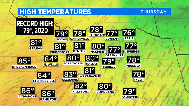
We see partly cloudy skies both Thursday and Friday but with strong SSW surface winds our temperatures will soar well above average. We could set a record high both Thursday and Friday. The record high on Thursday, December 9th is 79° originally set in 1906 and tied last year. I'm forecasting a high of 80° which will set a new record high temperature.
Friday the SW surface flow continues and as the cold front approached NTX we will see compressional warming. What is compressional warming? It is exactly what it sounds like. Air that warms as it gets squeezed. Since we have a strong cold front on the way there is a steeper leading edge of the colder air which in turn allows stronger squeezing.
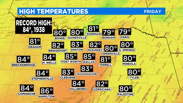
Record heat is expected again ahead of this cold front. The record high on Friday, December 10th is 84° set in 1938.
There is an additional concern the next few days. Fire. We've seen a few freezes, have dry vegetation and with the windy days ahead, the fire danger increases. Mainly along 281 and west of that. Please take caution with any outdoor burning.
The cold front drops our temperatures by 30° on Saturday with high temps struggling to warm into the mid 50s. By Sunday AM our temperatures will be slightly above freezing for the metroplex with some spots of NTX below freezing.
Simply put... the rollercoaster ride of temperatures continues.