Storms possible as North Texas faces heat and fire danger during opening weekend of State Fair of Texas

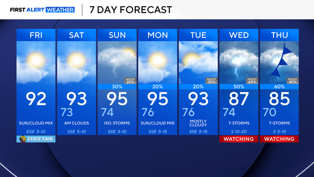
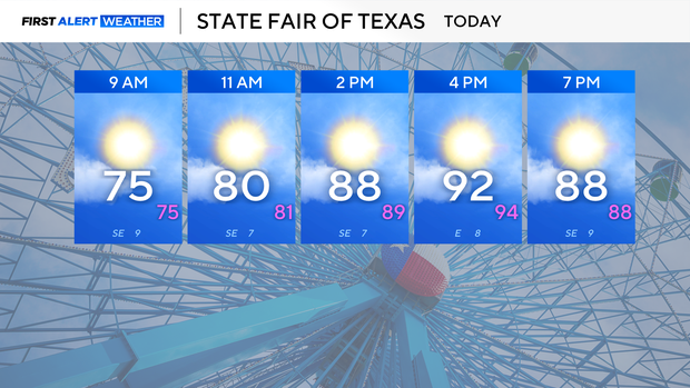
Happy, finally, Friday and opening day at the State Fair of Texas! It will be hot and dry with a few clouds in the sky.
Highs will reach the low to mid-90s on Friday afternoon. Relative humidity will be low today, increasing the risk of fire in the afternoon west of I-35.
Though conditions will be dry, there is still a chance of an isolated shower or storm on Friday for counties west of the metroplex.
Saturday will be hot, with highs in the mid-90s, winds from the southeast at 5 to 10 mph, and mostly cloudy skies. Saturday night will likely bring a chance for rain overnight through Sunday morning and early afternoon.
A better chance of rain is expected next workweek. An upper-level trough strengthens, and a cold front combined with moisture from the Gulf and the Eastern Pacific will cause the pattern shift. The forecast of when the front will move through, how much rain there will be, how strong the storms will be, and the cooldown is still being ironed out.
As for now, know that rain and highs in the 80s are expected over the next seven days.