Warm, breezy days in North Texas lead to critical fire danger later in the week


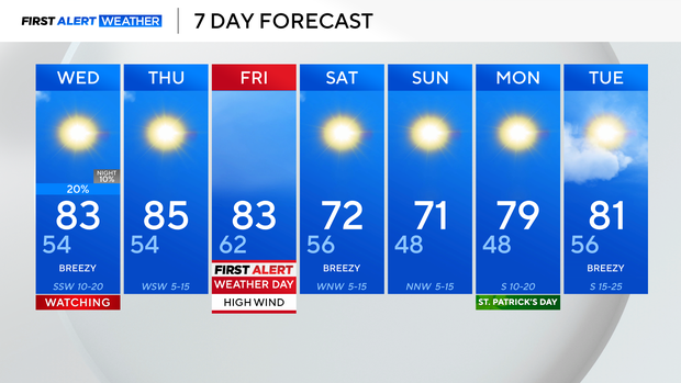
Temperatures continue to rise this week, with highs reaching the lower 80s Tuesday afternoon, which puts us 10-15° above average.
It was a breezy day, and that breeze will stick around for much of this week.
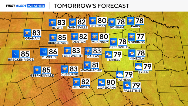
For our Wednesday, another warm and breezy one, with highs in the lower to middle 80s. Winds will gust 25-30 mph.
A dryline develops Wednesday afternoon and brings the threat for isolated thunderstorms Wednesday afternoon and evening.
Most of the area will remain dry, but where those storms do develop, they'll pack a punch, bringing a damaging wind and hail threat. The tornado threat is very low but not nonexistent.
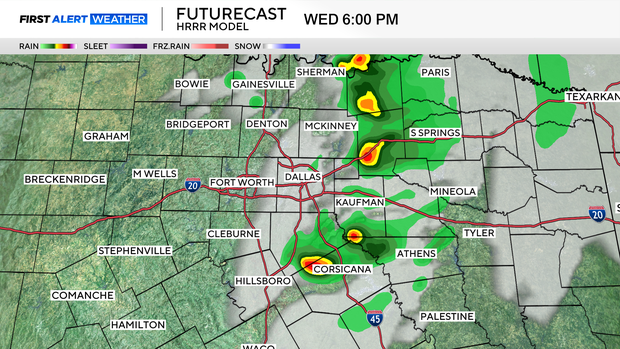
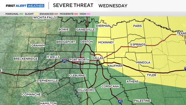
Threats look to be greatest east of I-35. Because of this, the Storm Prediction Center has put portions of North Texas under a level 1 or 2 out of 5 risk for severe storms. Storms clear up Wednesday night.
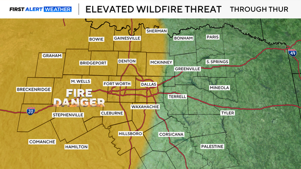
Outside of isolated storm chances Wednesday, we're dry the rest of the week, with very low relative humidity and breezy to windy conditions.
As a result, areas west of I-35 are under an elevated fire threat through Thursday.
That elevated threat turns Critical by Friday, as a low-pressure system moves through the Central Plains, bringing incredibly gusty conditions to North Texas.
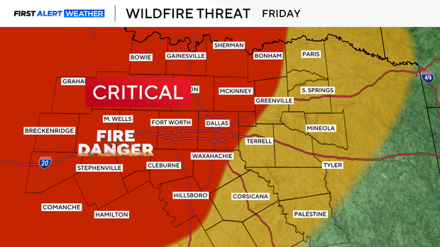
Expect sustained winds 20-30 mph, with gusts 45-55 mph. It is recommended to avoid activities that can create a spark, and don't discard cigarette butts. If any grass fires do start, they'll have the potential to spread very rapidly.
A cold front moves through into the weekend, taking temps from the 80s back to the 70s.