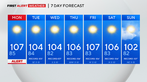
Triple-digit highs continue this week, most days with near record temps

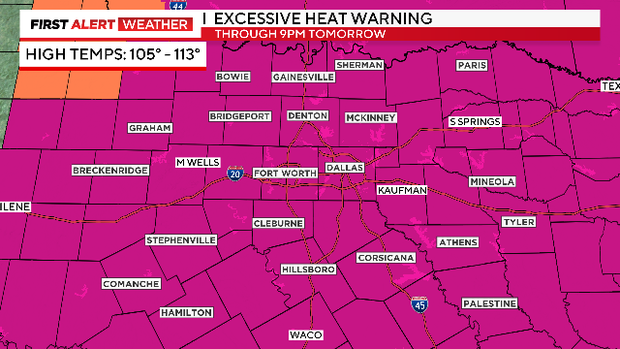
NORTH TEXAS (CBSNewsTexas.com) - Monday holds a Weather Alert Monday due to the Excessive Heat Warning, a Red Flag Warning, and an Air Quality Alert and we'll be close to another record high.
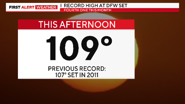
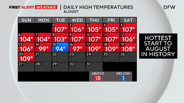
Another day, another record high.
What a run of heat! This was, again, the hottest weekend so far this summer. Each weekend has been hotter than the last for four weeks running. I looked through the weather record over the last two decades. The only 4-day run I found that averaged a higher daytime maximum temperature occurred at the end of August - start of September in 2000. That was 23 years ago.
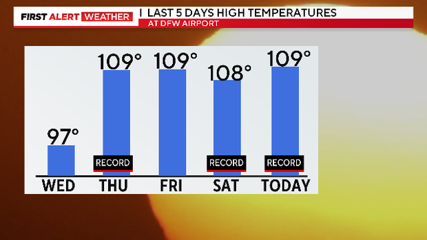
August is our hottest month on average. So far this is the hottest August on record.
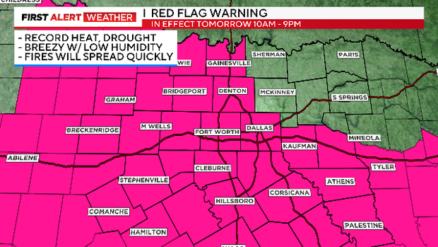
We continue with the Excessive Heat Warning for Monday. There is now a Red Flag Warning as conditions continue to dry out as the wind picks up.
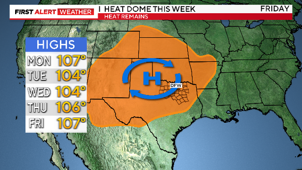
Don't look for relief this week. The heat dome sits over us all week. Each day is close to record highs for the date.
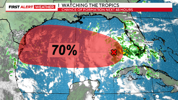
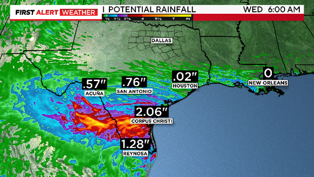
There is a chance a Tropical Storm could form in the Gulf of Mexico over the next two days. This tropical system won't have much time to ramp up, it'll quickly run right into south Texas bringing heavy rain.
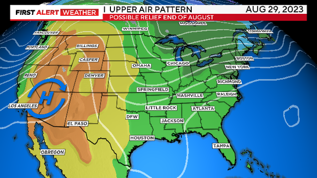
The rain stays well south of us. There is a hint of possible relief from the heat during the last days of August. It shows the ridge of high pressure (and heat) moving off to the west coast and bringing in highs under 100°. We'll see. And hope.
The above scenario still sits outside our 7-day forecast. By tomorrow we'll be 2nd on the list for most days 105° and higher. By Sunday we'll be 7th on the list for most 100° in a year. 35 days now and still no measurable rain at DFW. Summer misery.