Tornado Watch Until 10pm Tuesday
TORNADO WATCH UNTIL 10pm
Tornado Watch for those areas from Fort Worth to Dallas and to the north and east. Cold front is now moving past Gainesville into northern Denton County. Front as passed thru Decatur and nearing Weatherford at this time. Cumulus clouds are developing along the front, a sign that the CAP is weakening and storms are on the cusp of exploding. Storms have rapidly developed in southern Oklahoma and now across the Red River in Grayson County.
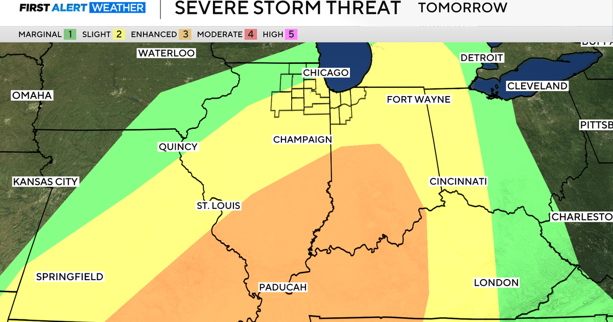
SEVERE WEATHER THREATS….
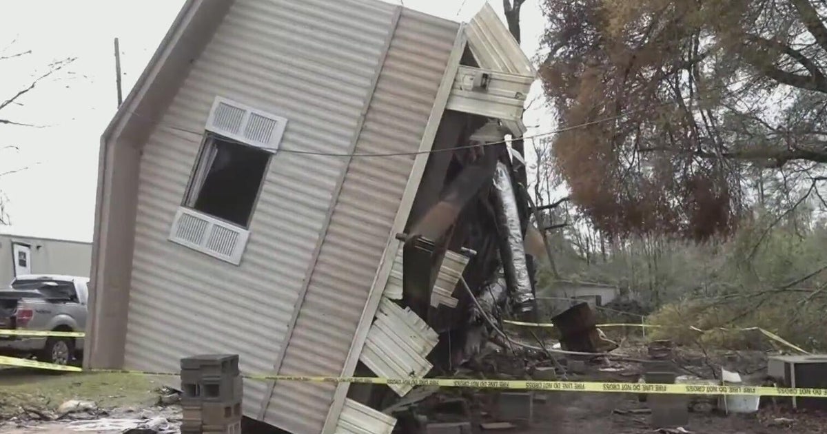
As these storms develop along the front in an area of very warm, moist air, severe weather will be likely. Looking at the profile of the atmosphere and the degree of instability, BASEBALL size hail will be a possibility with some of these supercell thunderstorms in the watch area this afternoon and evening. The window for severe weather in Dallas and Fort Worth will be between 4pm and 8pm. Then after that the threat will shift more to the east. There is still a tornado threat, but the low level winds will not have a great set up for rotation at the base of the clouds. But with the rotating updrafts so intense, this could overcome the lack of spin at the lower levels of the atmosphere. The threat for tornadoes appears to be much higher in southeast Oklahoma and extreme northeast Texas.
COOLER TONIGHT AND TOMORROW… BUT MORE STORMS POSSIBLE TOMORROW…
The cold front will bring cooler weather tonight and tomorrow. This front will stall near Waco tonight and tomorrow and then slowly lift back north as a warm front during the day tomorrow. Temperatures thanks to northeast winds and cloud cover tomorrow will only climb into the 70s. There will be scattered showers in the morning and then likely scattered showers and thunderstorms in the afternoon. Some of those storms tomorrow will be severe with hail the main threat. It doesn't look like a widespread severe weather event tomorrow, but a couple of storms tomorrow could be severe in the afternoon.
MORE STORM CHANCES LATER THIS WEEK…
We will get back into the warm moist air by Thursday and Friday. The dryline will set up just to our west each day. Severe storms will be possible along that dryline each afternoon and evening. Most of the storms will be riding toward the northeast and may not make it to the metroplex, but depending on the location of the dryline, storms could make it here to Fort Worth either or both days. This might also bring some rain to the area where the fires are burning.
WEEKEND…
Similar setup for the weekend with warm and humid weather and the possibility of storms each afternoon and evening along the dryline.
FIRE WEATHER…
Wind shift as happened at PK fire with winds to the northwest at 15 to 25 mph. Winds will veer to the northeast later tonight and stay to the northeast most of tomorrow. Humidity will climb a little tonight. Thursday and Friday will see south winds with higher humidity