Sunny Weather Short-Lived In North Texas As Possible Weekend Storm Approaches
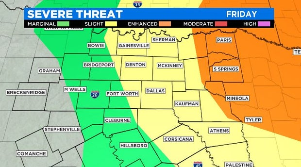
NORTH TEXAS (CBSDFW.COM) - Today's beautiful, sunny weather will be short-lived as our next storm system approaches on Friday. That storm continues to strengthen as it exits the Pacific Northwest and will continue to head towards the Plains, providing our next threat for severe weather Friday afternoon and evening.
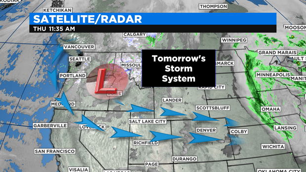
As of this writing (Thursday), the severe threat is not a slam-dunk. Models remain in a bit of disagreement on this event thanks to a "cap" that will be in place across the area. That is to say, the ability for our atmosphere to fully tap into the available instability is uncertain at this time. This will all play out early tomorrow. If we get some sunshine to break through, this would increase our likelihood for severe activity.
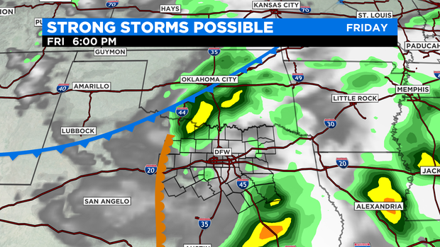
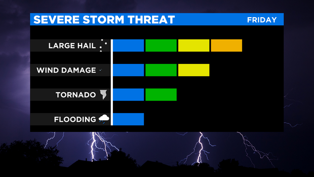
The severe potential in North Texas focuses on supercell development that could begin as early as 3 or 4 PM Friday. With these storms, very large hail (golf ball-baseball size) appears possible. Other severe modes are possible, but the greatest focus remains on the hail threat. Activity is most likely to impact locations along and east of I-35 as a dry line pushes in late tomorrow. Storms will likely be scattered in nature and should make an exit before midnight.
With this event still over 24 hours out, forecast details are not certain so continue to monitor the latest forecast here on CBSDFW.com.