Severe Storms Possible Tuesday in North Texas: Storm Timeline
SEVERE THREAT
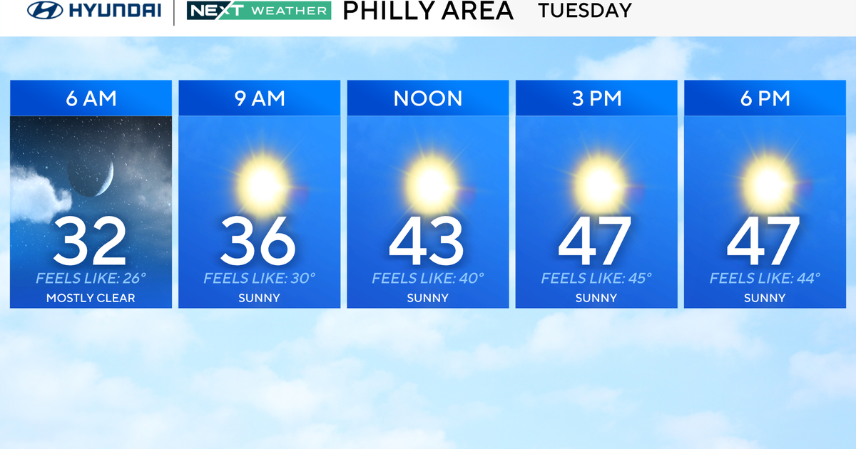
This warm, muggy weather will give way to Spring like thunderstorms tomorrow for North Texas. The timing of these storms looks to be late morning into early afternoon in the DFW Metroplex.
North Texas is under a slight risk for severe weather tomorrow. There is a slightly higher threat of severe weather in our eastern counties.
High winds will be our greatest threat, but large hail and even an isolated tornado is possible.
TONIGHT:
The upper level disturbance seen here to our west, will draw closer tonight.
There will be enough lift in the atmosphere to generate a few showers and isolated thunderstorm after midnight in North Texas. Most of these will stay below severe limits overnight. Although some stronger storms will be possible for areas along the Red River and NW of DFW.
TOMORROW:
Scattered showers and thunderstorms will be with us in the morning. Storms will come together in a line likely over the I-35 corridor around the lunch hour and then progress eastward. As this line forms, strong to severe storms will be possible with the severe threat increasing as the line moves east. Storms should clear the DFW Metroplex by 3pm.
STORM TIMELINE:


