Possible strong to severe storms Wednesday in North Texas
NORTH TEXAS — Our First Alert Weather Team has issued a weather alert for Wednesday and Thursday.
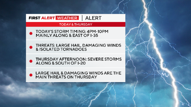
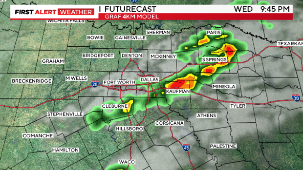
As we move through this Wednesday, heads up: A few isolated strong to severe storms are possible late this afternoon and evening in parts of North Texas as a dryline and cold front approach the area. Communities along and east of I-35 will have the highest threat for storms that could be severe.
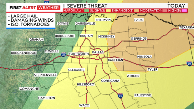
Large hail, damaging winds and an isolated tornado are all possible today. Storms will likely impact our area between 4 p.m. and 10 p.m.
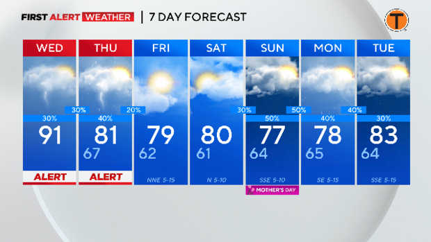
Otherwise, expect a mix of sun and clouds today. It will be hot with high temperatures in the low 90s.
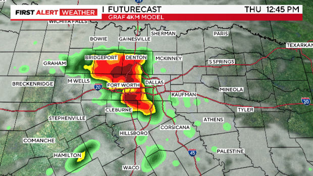
On Thursday, as the cold front pushes south, there will be a threat for strong to severe storms again in parts of North Texas, especially Thursday afternoon and evening between 3 p.m. and 10 p.m.
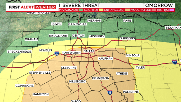
Large hail and damaging winds are the main weather threats Thursday, mainly for areas along and south of I-20. We'll watch the storms closely. Highs will be in the low 80s.
We're expecting partly cloudy skies on Friday with highs in the upper 70s.
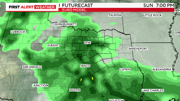
Mother's Day Weekend will not be a washout. However, prepare for rain on Sunday.
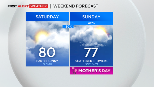
Saturday brings partly sunny skies with highs near 80.
On Mother's Day this Sunday, expect mostly cloudy skies and scattered showers. Isolated storms are possible, but the threat for severe weather is low. Highs will be in the mid to upper 70s.