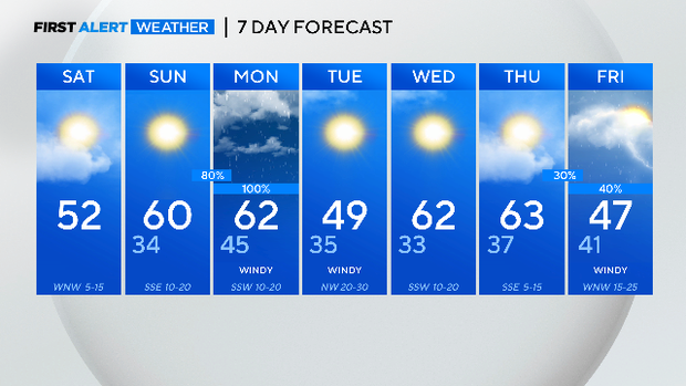
Pleasant, cool weekend ahead of rain next week
NORTH TEXAS - Our eastern counties are waking up to some patchy dense fog with an advisory through 9:00 a.m. Visibility could drop below a ¼ mile at times.
Fog is not an issue in the Metroplex where visibility is around 10 miles with cloudy skies.

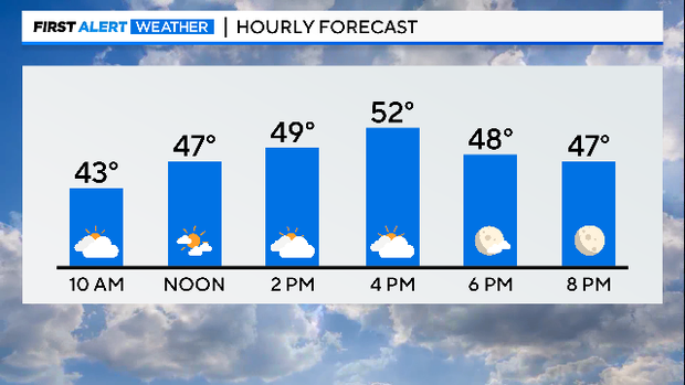
A chilly start with temperatures in the 30s and low 40s. You will want the jacket as a breezy northerly wind is adding a bite to the air.
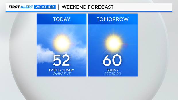
Today will be partly sunny as a disturbance slides through the area. An afternoon sprinkle or two can't be completely ruled out, although most of us remain dry.
The sunshine and breezy southerly winds return tomorrow, making for a pleasant end to the weekend. Temperatures will be back in the lower 60s tomorrow afternoon.
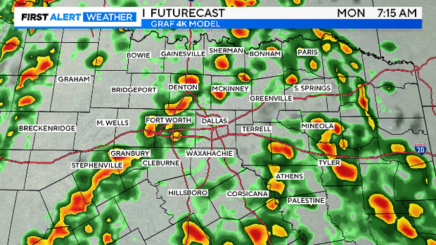
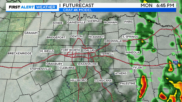
Our next system arrives Monday returning widespread rain to the area. Showers will be ongoing for the morning drive and clear out just after the evening drive.
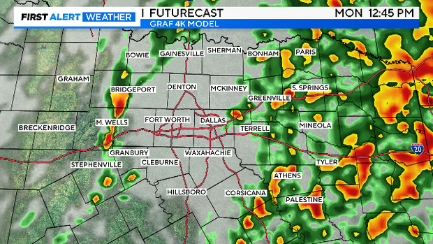
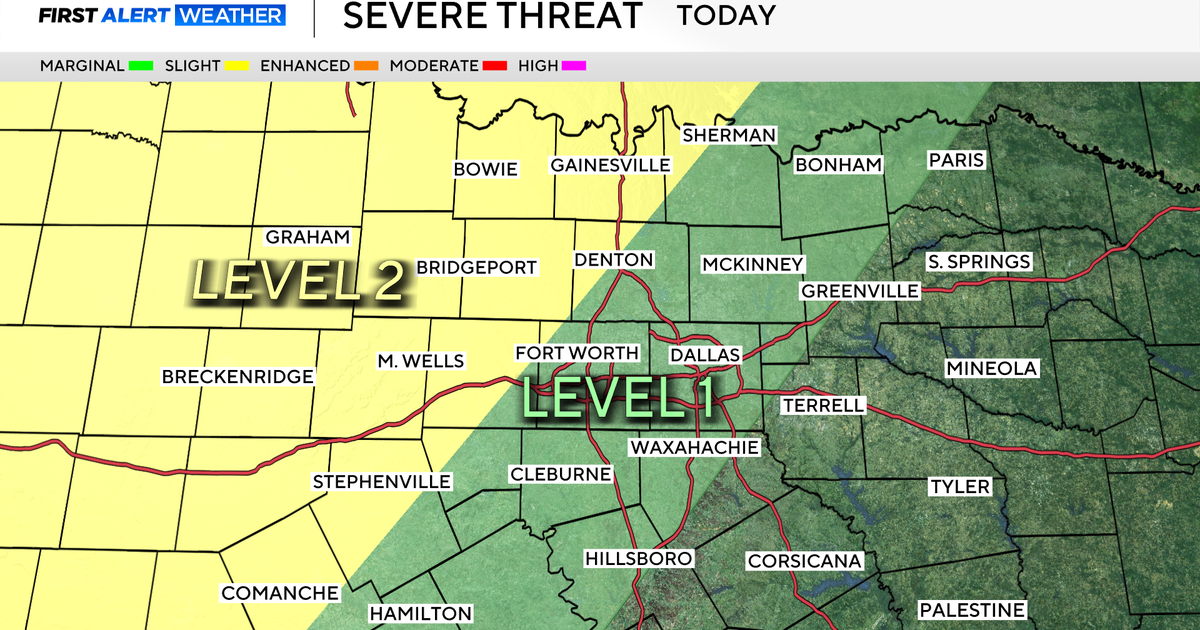
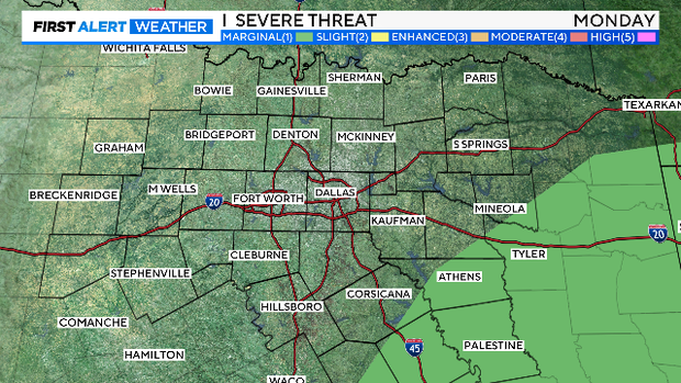
The severe threat is low but a few stronger storms capable of gusty winds and small hail are possible in our southeastern counties.
Behind Monday's system, strong northerly winds develop returning cold air to the region and keeping highs in the 40s.
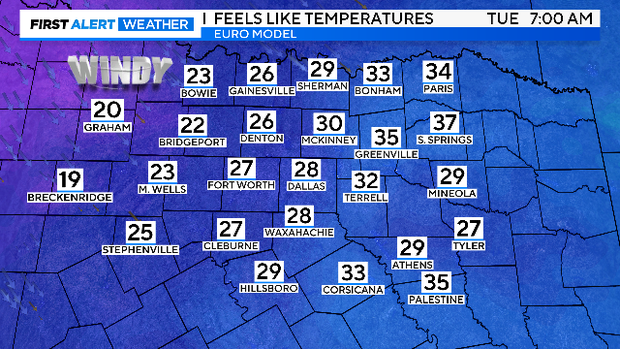
Wind chills Tuesday morning will be in the 10s out west and in the 20s for the Metroplex.
You will really want the layers if you plan to be outside on Tuesday as winds will gust to near 40 mph! Yikes!
Bring in the holiday decorations this weekend if you can!

Luckily, the sunshine returns Tuesday and lasts through Thursday.
Then another system arrives Friday bringing more rain and a push of arctic air just in time for the weekend!