Hot and dry Saturday ahead of possible stronger storms for North Texas possible this midweek

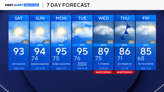
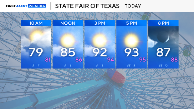
Saturday will be hot and dry, with a few clouds across North Texas. Highs will reach the low 90s this afternoon with winds from the southeast 5 to 10 mph.
Though conditions will be dry for most of the day, there is still a chance of an isolated shower or storm in counties west of the metroplex later tonight through early Sunday morning.
On Sunday afternoon, more storms are possible. The morning low will be in the mid-70s and the high in the mid-90s. Expect partly cloudy skies and winds from the south at 5 to 10 mph.
A better chance of rain is expected next workweek. An upper-level trough strengthens as it moves from west to east. At the surface, a cold front will tap into moisture from the Gulf and the Eastern Pacific. This will lead to storms and a healthy chance of rain.
The forecast of when the front will move through, how much rain, and how strong the storms, as well as the cool down, is still being ironed out. As for now, know that rain and highs in the 80s are expected by midweek.