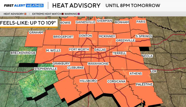
North Texas under a heat advisory for Tuesday

The heat advisory has been extended through at least 8 p.m. Wednesday night, and further extensions in the upcoming days are likely.
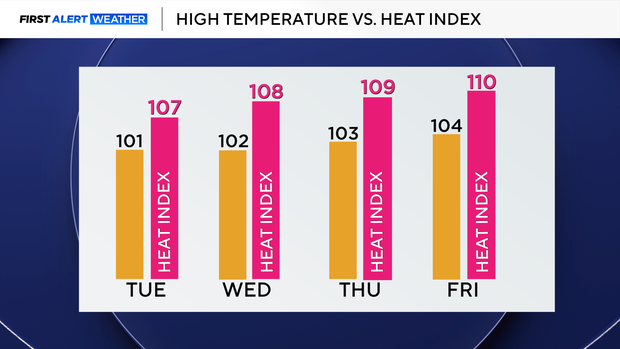
Temperatures will remain in the triple digits through the start of the weekend, with heat index values between 105-110°F. A weak cold front enters the area early Saturday morning, but no significant cooling is expected other than a few degrees taken off for Sunday and Monday.
Nighttime temperatures will struggle to cool off throughout the week and they will remain in the low 80s across the area.
Moving into the latter part of this week, temperatures will progressively warm, and the heat index will rise to as high as 115°F by Friday. With the ridge of high pressure nearby through Friday, no rain chances in the forecast, as we stay hot and mainly dry.
The ridge of high pressure will move off to the west into portions of the Desert Southwest, where places such as Death Valley could near their all-time record high of 130°F. This will open the door for a northwest flow aloft to enter the area and sneak in a weak cold front early in the morning on Saturday. After the passing of this front, temperatures hover in the upper 90s on Sunday, but no noticeable relief is expected.