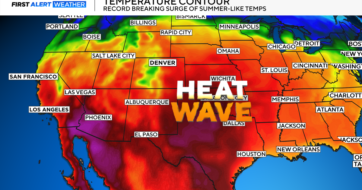
Near Record Heat Ahead
THE WARM UP BEGINS TODAY
Breezy south winds take over today as two atmospheric players get into position to create North Texas' rapid warm up. The first is the upper level ridge currently over Arizona and New Mexico…this represents the overall warming trend. The second is the surface low developing in eastern Colorado. As it strengthens, it will produce strong south winds across North Texas that will enhance our warm up and also pump more humidity into our atmosphere.
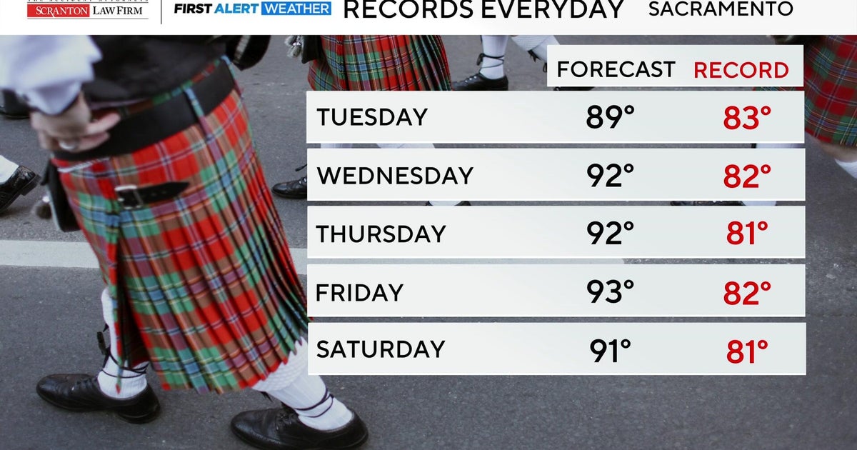
Temperatures today will make the low and middle 80s. Wednesday through Friday, they will push into the upper 80s with western sections of North Texas seeing the 90 degree mark for the first time this season. The standing record highs Wednesday through Friday are 91-93 degrees. The last time DFW officially hit 90 degrees was back on October 7th, 2011. Right now, still holding back on calling for DFW to officially hit 90 degrees or hotter this week. But, it is a possiblity.
Our FutureSky Forecast model below is picking up on the big warm up in West Texas and the Big Bend. Even the Abilene area will push close to the century this week.
Along with the near record heat, very windy conditions will prevail and may be strong enough on Friday to warrant a Wind Advisory for most of North Texas. The warm, windy pattern will shut down as a cold front pushes into North Texas on Saturday. Right now, looking like a 20 percent chance for a shower or non-severe storm Saturday evening and a 30 percent chance Sunday.
TODAY:
Sunny, breezy and warm. High 83. Winds: S 10-20.
TONIGHT:
Clear, breezy and mild. Low 64. Winds: S 10-20.
WEDNESDAY-FRIDAY:
Sunny, windy and hot. High 87-89. Winds: S 15-30.
SATURDAY:
Variable clouds, 20 percent chance for evening showers/storms. High 84. Winds: S 10-20.
SUNDAY:
Mostly cloudy, 30 percent chance for showers/storms. High 76. Winds: N 10-15.