More clouds Thursday, strong to severe storms Friday

NORTH TEXAS (CBSDFW.COM) - The First Alert Weather Team has called a First Alert Weather Day for Friday. CBS 11 meteorologists expect strong to severe storms to develop through the late morning/early afternoon and move east through the afternoon to early evening hours.
The latest data shows the front moving into the northwest sides of North Texas close to noon. As the front moves east, showers and storms increase along the boundary.
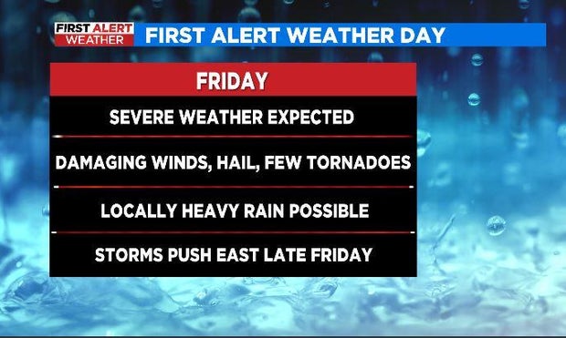
Meteorologists are watching for isolated storms out ahead of the front that could reach severe limits with all severe modes possible.
Between 2 p.m. to 4 p.m. the line should solidify a bit more as it moves east. This could happen right over the metroplex causing travel issues with pockets of heavy rain. By the afternoon commute, the broken line looks to be east of the metroplex. One caveat is one forecast model that is delayed by 2-3 hours. If that verifies, then storms should move in over the metroplex during the evening commute.
That means large hail, damaging winds, a few tornadoes are all possible. There is the possibility of localized flooding with some of the heavier rain with these storms. The highest rain accumulation of 1"-2" looks to be east of the 35 corridor.
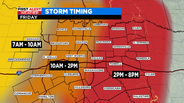
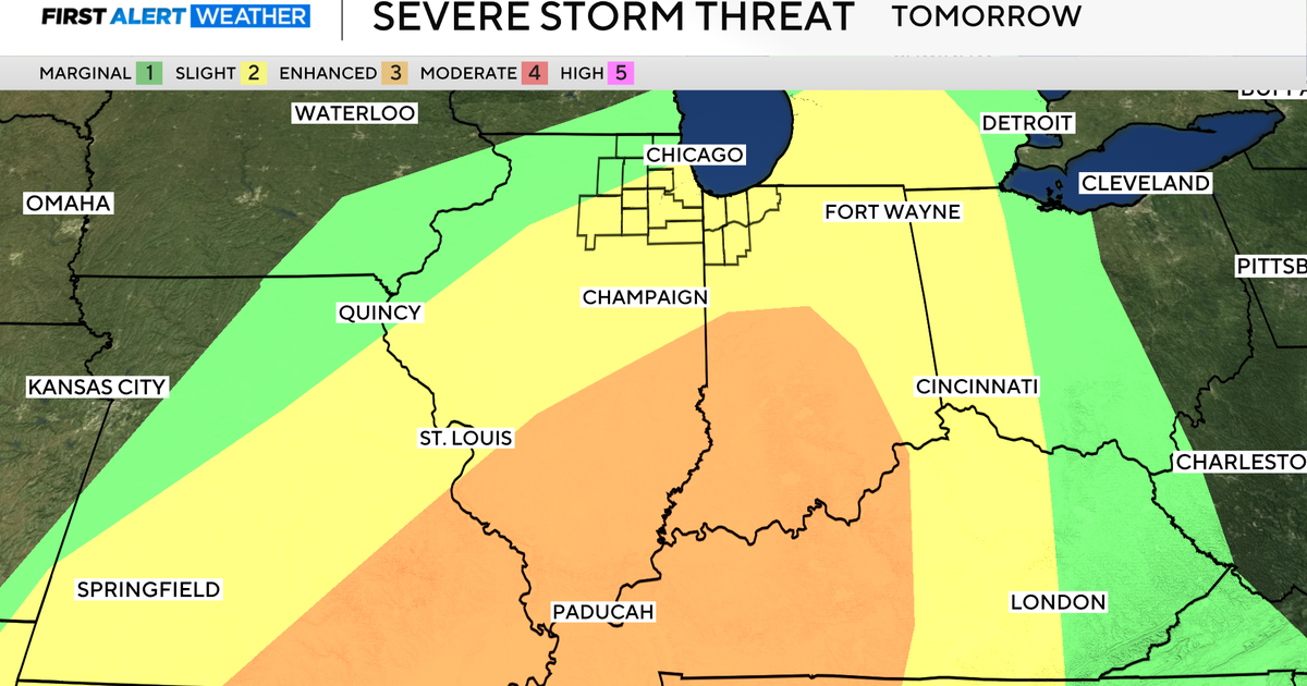
Most of North Texas is under a slight risk of severe storms with the level three enhanced risk along a line from Paris to Corsicana and east of that.
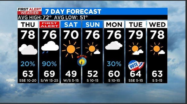
But don't worry, a beautiful weekend is in store after Friday's storms. Don't let the morning temperature on Saturday fool you. Plan to grab the coat as morning temps dip to the upper 40s. However, get outside this weekend because there's plenty of sunshine and temps in the low to mid 70s.