Beautiful Monday Weather But Dry Conditions, Strong Winds Elevate North Texas Fire Danger
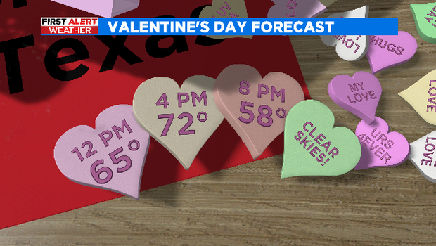
NORTH TEXAS (CBSDFW.COM) - How about lots of sunshine, breezy southerly winds, and highs in the low 70s to ease you back into work after Super Bowl weekend? That's what we have on tap for your Valentine's Day, it is looking beautiful!
The Metroplex is still very dry and with today's strong winds there is an elevated fire danger for most of North Texas.
Hopefully you enjoy today's warm temperatures because we have a repeat in store for Tuesday, but there will be a few more clouds around.
Changes arrive midweek as our next weather system moves in. Rain could start as early as Wednesday morning and continue through midday Thursday.
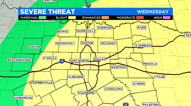
There is a slight risk of severe storms late Wednesday into early Thursday morning, with damaging winds the main threat. The timing and impacts of this system will continue to be refined as we get closer.
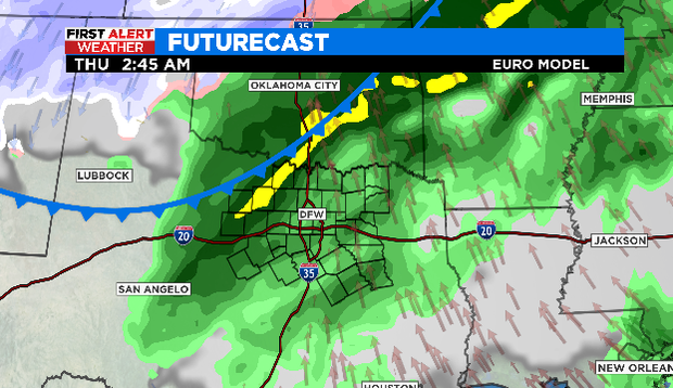
Behind the cold front temperatures will fall through the day on Thursday. Strong northerly winds will continue to usher in colder air. A light rain/snow mix can't be ruled out Thursday morning as the system pulls away.
Conditions are already improving Friday with lots of sunshine and temperatures back in the mid 50s. As it stands, next weekend is looking great.