Mix of sun and clouds with storms possible in North Texas
NORTH TEXAS — We are starting off with some clouds this morning but expect a mix of sun and clouds for the afternoon with temperatures climbing into the upper 80s.
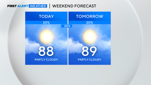
The humidity will make it feel like the mid 90s this afternoon so remember your heat safety precautions and the sunblock if you are spending the day at the pool.

If your plans take you outdoors today, keep an ear out for thunder as spotty storms are possible. When thunder roars, head indoors. Most of us stay dry today with coverage of storms around 20% and mainly around the early afternoon hours.
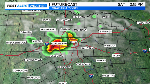
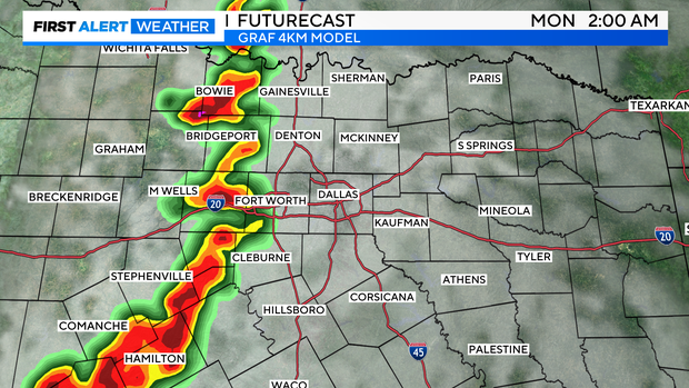
Another complex of storms will make a run at North Texas from the northwest heading towards sunrise tomorrow. Don't be surprised if you get woken up by rumbles of thunder. After the morning storms dissipate, a few spotty storms are possible in the afternoon.
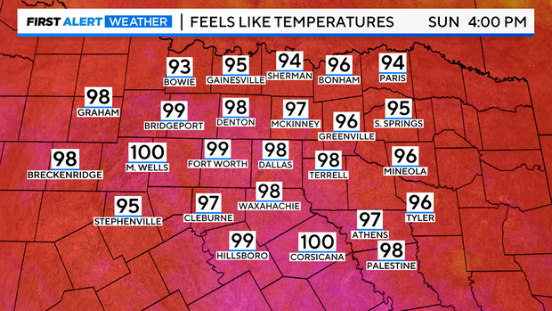
The heat and humidity continue to build on Sunday pushing temperatures back into the upper 80s and feels like temperatures in the upper 90s!
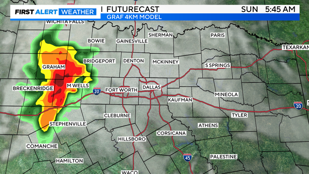
We will be watching for storms to develop along the dryline out west Sunday afternoon and head east in the evening hours. Our western counties have the best chance of seeing storms as a weakening trend is expected the closer they get to I-35.
A much drier and hotter week is ahead as a ridge begins to build in the area. Temperatures return to the mid 90s with feels like temperatures back in the triple digits.