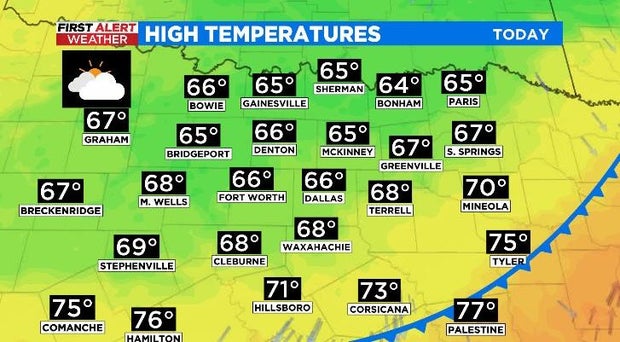
Metroplex highs Tuesday only in 60s, under cloudy skies
NORTH TEXAS (CBSDFW.COM) - Was anyone else looking for a jacket this morning? It wasn't exactly what we expect to step outside to on May 3rd in North Texas.
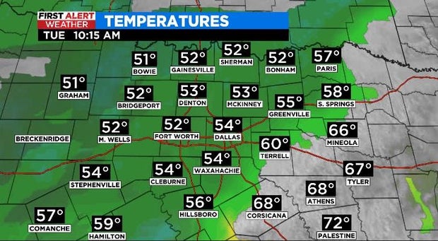
By late morning temperatures were still in the 50s for most of the Metroplex, all thanks to an overnight cold front.
As it stands, afternoon highs on Tuesday will only be in the 60s, under cloudy skies and with a north wind. There will be a few spots farther south and east that may be a little warmer, as they're closer to the front and didn't get quite as cool as quickly as the rest of us.
Rain chances aren't out of the question. For today and tonight there is a 20% chance for isolated showers. While nothing severe is expected Tuesday, the CBS 11 Meteorologists are keeping their eyes on tomorrow and into Thursday.
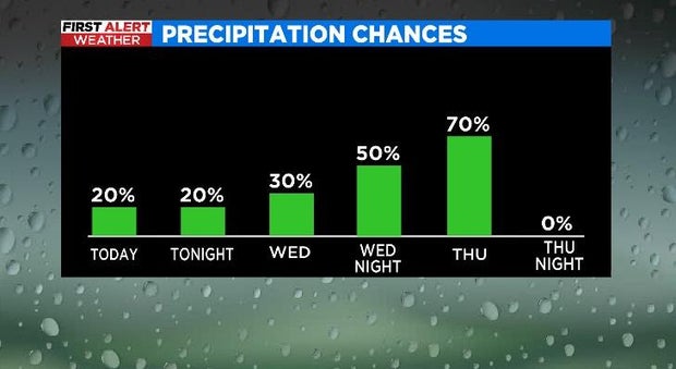
It looks like storms will develop out west, near a dryline, on Wednesday afternoon. Right now, it isn't clear how much activity we see here in North Texas on Wednesday, so it's something that we're monitoring.
The weather models are in pretty solid agreement on the storms becoming more widespread overnight into Thursday morning, ahead of a cold front. That's where North Texas will see 70% coverage on Thursday.
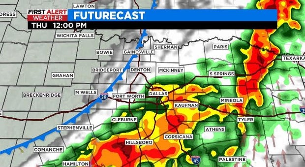
The weather is expected to have the biggest impact during the morning and midday, then push east in the afternoon. The main threats with this line of storms will be from high winds and heavy rain.
The good news? Friday and into the weekend will be calm, dry, and hot, when high temperatures are expected to reach the mid 90s.