Light showers bring cooler temperatures, but it's still hot
NORTH TEXAS (CBSNewsTexas.com) - Some strong storms overnight knocked out some power across DFW. A few showers and storms redeveloped Saturday morning over the Metroplex along a weak frontal boundary. Nothing severe, just some welcome rain, especially for Dallas county.
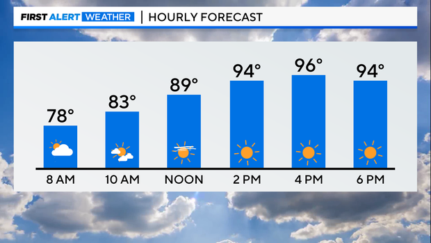
The rain will continue to taper off late morning and sunshine returns for the afternoon hours, when highs will top out in the 90s.
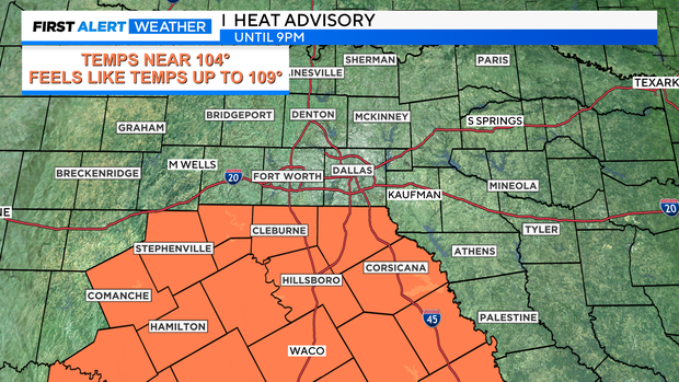
While DFW is not included in any heat alerts today, areas south of I-20 are under a Heat Advisory until 9pm.
A disturbance clips our western counties Sunday morning and could generate a few showers and storms to start the day.
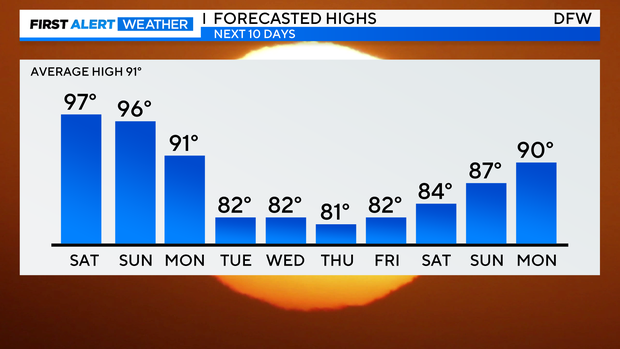
But once again, by late morning the precipitation ends and we are left with sunny skies and highs in the mid 90s.
We are finally tracking a cooldown this week. Highs will be in the 80s, mornings in the 60s and there will be rain around, bringing in cold fronts.
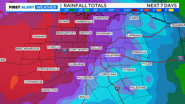
As the pattern shifts, there will be multiple chances for rain next week and some areas could get a few inches of rain over the next 7 days. It won't be a washout all day, but scattered showers are possible all week starting Monday evening.