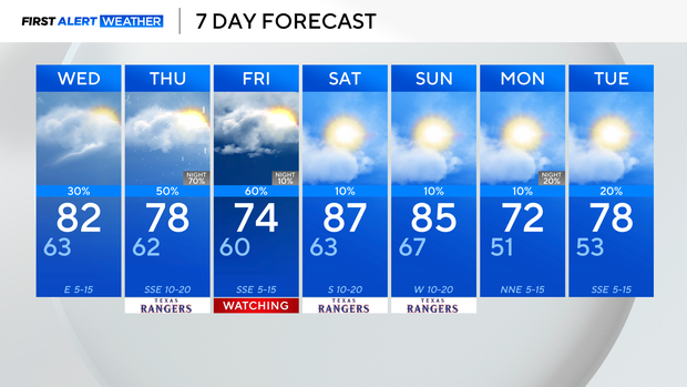
Above average temperatures and intermittent storm activity ahead for North Texas


We are watching some isolated shower/storm activity Tuesday evening. A few of these storms have turned severe, with hail anywhere from quarter- to egg-sized, and wind gusts up to 60 mph.
We go from isolated storms to scattered in nature for our northeastern North Texas areas Tuesday night and into Wednesday morning. This is as a cold front works through the area, bringing the shower and storm threat to those areas, before tapering off into Wednesday afternoon.
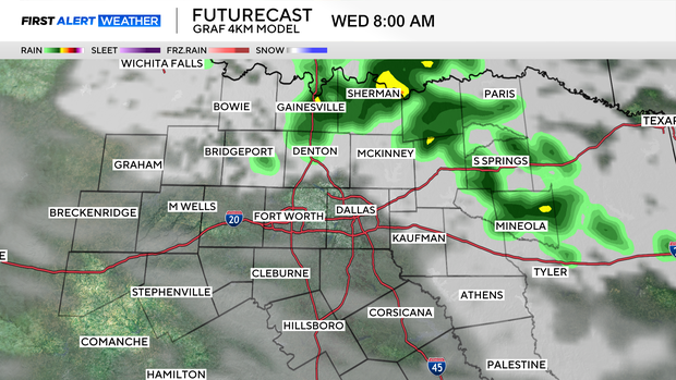
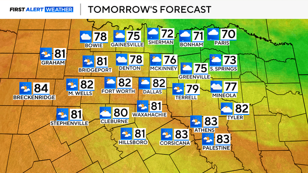
This front drops high temps back into the lower 80s for the metroplex, and the low to mid 70s for areas to the northeast and along the Red River, where clouds and precipitation will keep things a bit cooler.
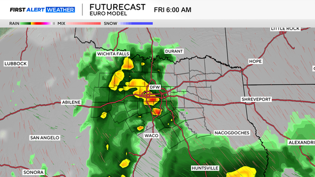
Rain and storm chances start to increase Thursday and Friday as southerly moisture moves into Texas, bringing more widespread shower activity.
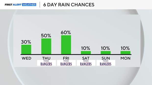
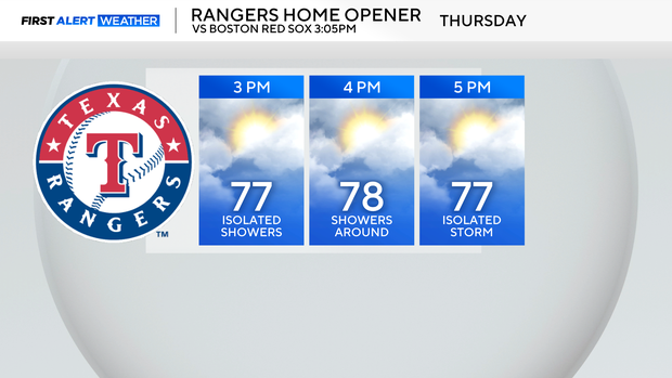
For the Texas Rangers' opening day, highsare in the upper 70s, with scattered shower activity around the region.
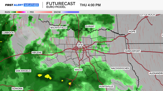
Showers then look to increase in coverage and intensity late Thursday, overnight into Friday morning. This is when the bulk of our rain is expected, with totals between today and Friday expected to be anywhere from 0.5"-2". Some localized pockets could be higher.
Shower activity looks to taper into the weekend, with only isolated shower chances. Overall, looking mainly dry for Saturday and Sunday, with high temperatures sticking well above average for this time of year.