Hot, Windy Monday; Storms NW
Temperatures hit 102° at DFW for Father's Day, that is within one degree of the record for this date. Wind gusts hit 41mph during the day as the Red Flag Warning continues until 9pm. Storms that form along the dryline far out to our west might get into Montague, Jack or Palo Pinto counties late tonight but chances are rather small.
MORE HEAT TOMORROW
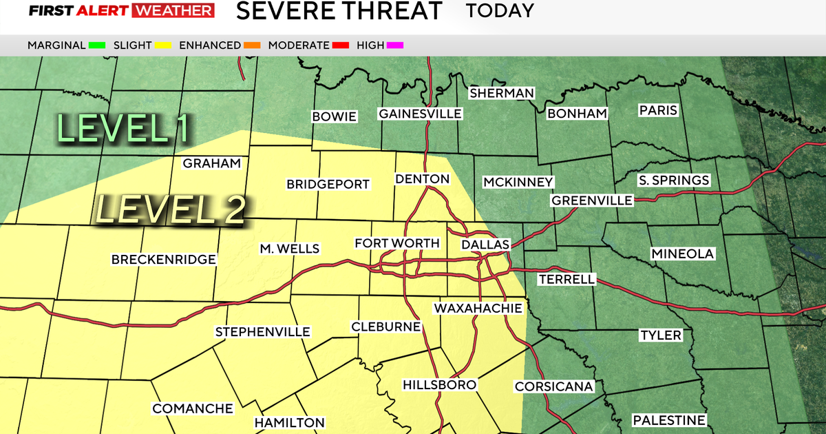
Highs on Monday will be a little less, we are forecasting a high of 99° at DFW. There should be some morning clouds across the metro area and perhaps even some light rain in our northern Red River counties. We'll still see triple number highs in many our western counties and again have very strong south winds. The dry line will move closer to north Texas by afternoon and help trigger some strong storms. The SPC puts a slight risk of severe weather tomorrow in a Sherman to Weatherford line and west.
On Tuesday a cold front comes into north Texas to do what the Mavs did last Sunday, vanquish the heat. Tuesday night and Wednesday we'll enjoy our best coverage of rain we've had since May 24th (the tornado outbreak). Some areas could get as much as 1"-2" of rain. The temperatures get knocked down as well; highs on Tuesday in the mid-90's and barely at 90° on Wednesday.
RIGHT BACK TO HOT
We expect the hot and dry weather to return by Thursday. By Saturday we are forecasting a return to 100° weather. The outlook for temperatures out to the start of July suggest typical summer heat, at least in the low 90's but not the near-record highs that we've had now for seven days running.