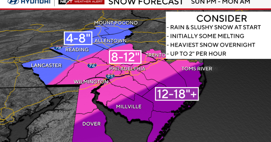
First Alert Weather Day after 4PM as storms begin in the west
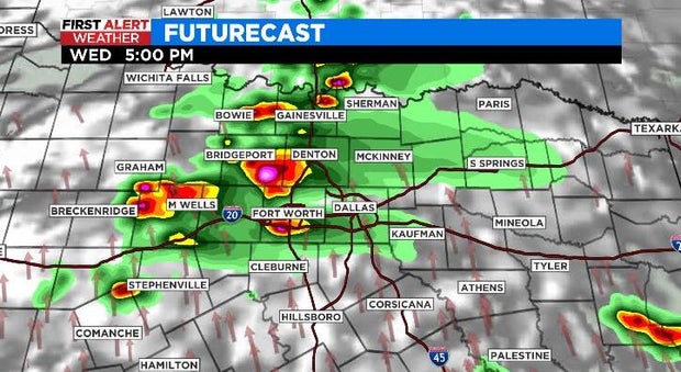
NORTH TEXAS (CBSDFW.COM) - It's a warm and muggy morning as we wait for the stormy weather to begin. We're expecting storm development to begin out west early this afternoon, but we'll watch after 2:00 p.m. to see where storms begin to initialize for our western counties.
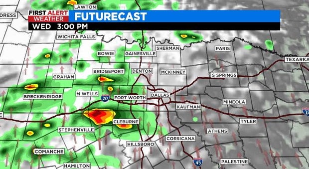
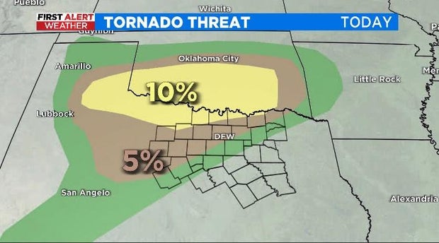
The timeframe for storms today/tonight looks to be between 2:00 p.m. and 9:00 p.m., with a focus on the hours of 4:00 p.m. to 7:00 p.m. for the Metroplex. Large hail and damaging winds are of the most concern with these storms, but a tornado threat exists too -- especially to the north and west.
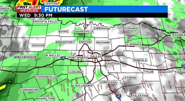
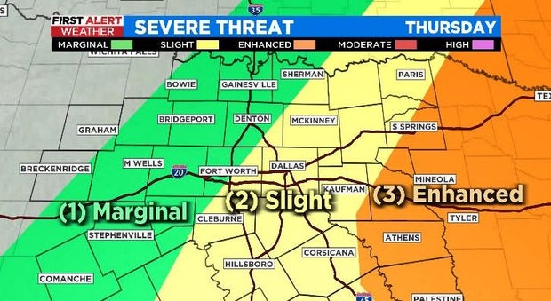
We get a lull in storm activity overnight, but as a cold front approaches Thursday we're expected to see a line of storms develop and move through the region.
Keep in mind, this time of year is really tricky with severe weather forecasting. Frequently the activity from the day before has a major impact on the day-of forecast and it can be sometimes difficult to predict until we're already in it.
So for now, models have a robust line of storms moving through the region after daybreak and continuing/intensifying as they push east into the afternoon.
I think the main threats, if the storms materialize, would be from strong winds along the leading edge and a heavy rain/flood threat. The CBS 11 Meteorologists are watching to see how much activity we get today and tonight and how quickly the atmosphere recovers as the next front approaches.
Once the rain moves out on Thursday afternoon, it's smooth sailing into the weekend. And this is when things are going to really heat up! I had "99º" for a forecast note on Sunday… I wasn't quite ready to go there yet, but we'll see. Regardless, there will be plenty of sun and southwest winds as things heat up.