North Texas faces threat of strong to severe storms to begin workweek

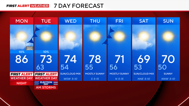
It's a First Alert Weather Day from Monday night through Tuesday morning due to the threat of strong-to-severe storms.
During the day, the Dallas-Fort Worth metroplex stays dry, so leave the umbrella at home. Expect highs to soar into the mid-80s with the help of gusty southerly winds up to 35 mph at times.
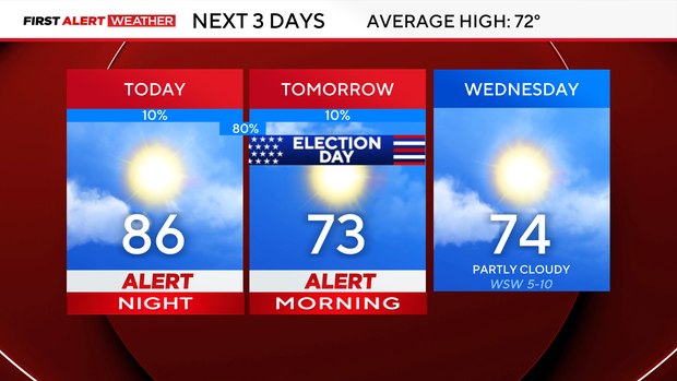
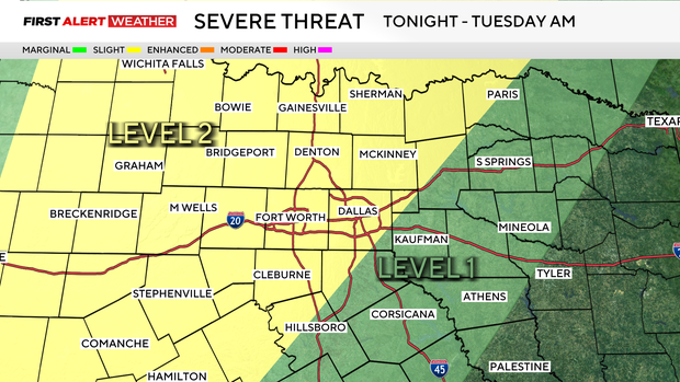
Most of North Texas is under a level 2/5 risk of severe storms, including DFW. Damaging winds will be the main threat, along with some hail and isolated tornadoes. Expect storms to build into the western counties as soon as 6 p.m. Monday evening, and eventually push into the metroplex as soon as 11 p.m.
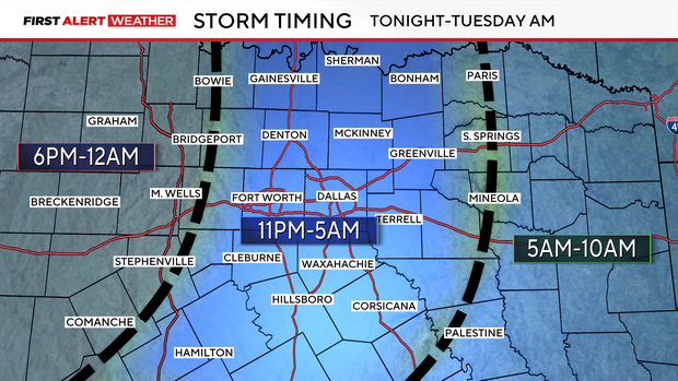
Fortunately, most of the rain is to the east by the Tuesday morning commute. The eastern counties will see lingering rain into the morning, so if you plan to vote, you may want to wait until midday.
Once the front moves through, the weather is quiet the rest of the week.
Another cold front will move in on Thursday, but it will be a dry front. This will drop temperatures to the 60s for highs on Saturday, with lows falling into the 40s by Sunday morning.