Warm, breezy to start the work week in North Texas before rain and storm chances increase
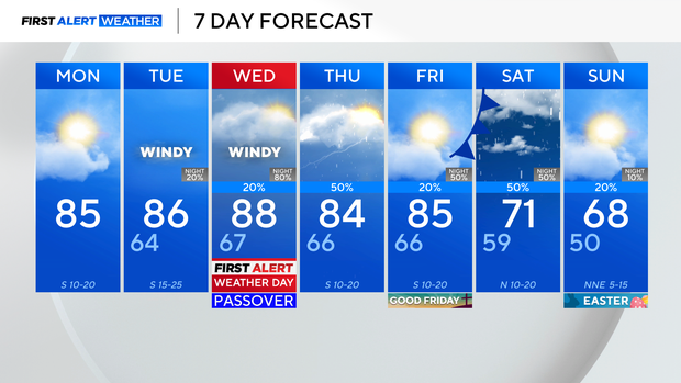
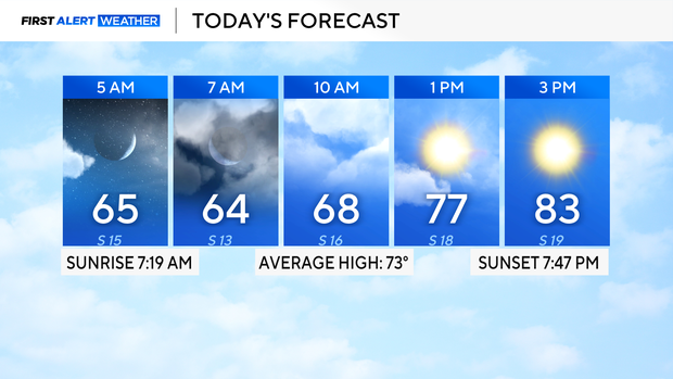
It's a quiet start to the workweek with temperatures in the 60s on Monday morning. Expect breezy winds and partly cloudy skies as temperatures soar into the mid-80s by afternoon.
Pollen levels are at 11.8 out of 12 on Monday and will continue to stay in the high category over the next few days.
The dry weather will end as the pattern changes, turning unsettled by midweek.
Wednesday will be a First Alert Weather Day due to the threat of strong to severe storms developing at night into Thursday morning.
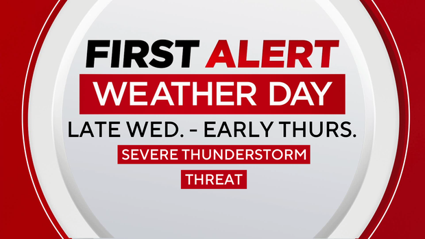
As of right now, most of the viewing area is under a level 1/5 risk of severe storms, with heavy rain, wind and hail being the main threats. The First Alert Weather Team will keep you updated and fine-tune the details as it gets closer to the event.
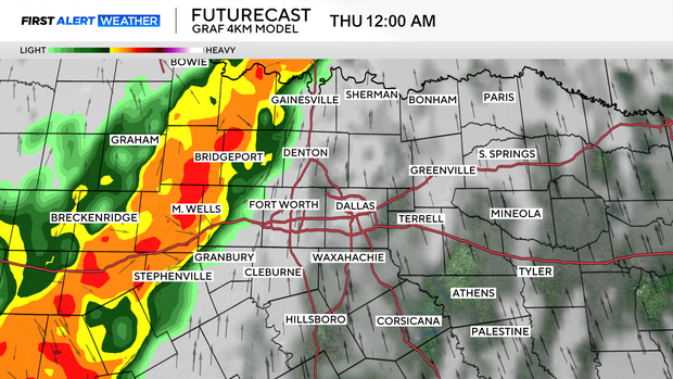
Plan for a wet start on Thursday as these showers and storms linger and move east. It will be mainly dry during the day on Good Friday, before another round of showers and thunderstorms returns on Saturday.
Most, if not all, of the rain looks to be done for Easter Sunday with below-average temperatures in the upper 60s.