Heavy rain, cold temperatures in North Texas may disrupt Sunday plans

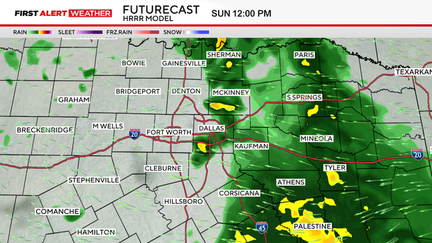
Sunday is a First Alert Weather Day due to disruptive rainfall. Rain will be the heaviest in the morning hours, gradually decreasing in the afternoon.
There may be a few rumbles of thunder, but no severe weather or flooding is expected. Anyone with morning plans should use caution while driving, as roads will be wet.
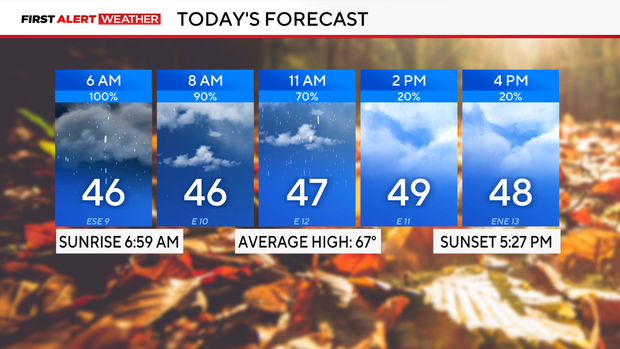
Drizzle and light showers will remain a possibility throughout the rest of Sunday and even into the overnight hours.
The cloud cover and rainfall will keep temperatures well below average with highs struggling to get out of the 40s in the afternoon. Sunday will likely be the coolest day North Texas has seen since mid-March. Winds from the east, gusting up to 25 mph, may make it feel even cooler.
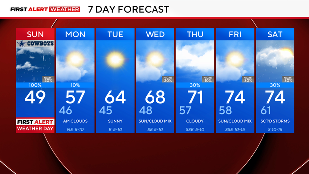
A warming trend begins during the work week. On Monday morning, expect drizzle and patchy fog with temperatures in the 40s with cloudy skies. Sunshine will move in by the afternoon and highs will reach the upper 50s.
A ridge of high pressure begins to strengthen on Tuesday, leading to warmer temperatures and allowing for more sunshine to break through the clouds.
The next disturbance is looking to pass through North Texas on Thursday, which will bring another opportunity for an isolated storm. More activity and the next cold front is on tap next weekend.