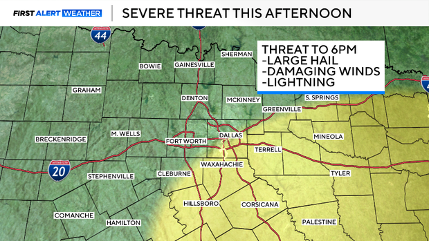
Storms approach parts of North Texas Friday afternoon ahead of cold front
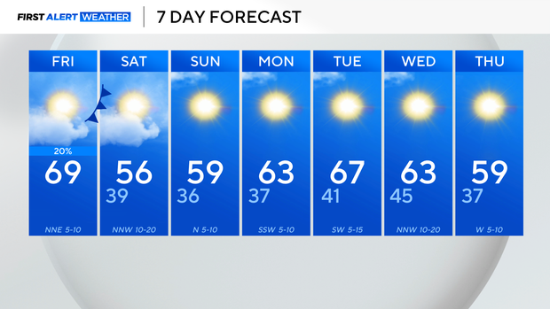
Friday morning in North Texas started out 15 to 25 degrees cooler compared to Thursday, with temperatures in the 40s and low 50s. The region is seeing a mix of sun and clouds, depending on the area, with highs in the upper 60s.
Severe weather is possible; thunderstorms capable of producing quarter-sized hail and wind gusts of up to 60 mph struck west of Waco around midday. A severe thunderstorm warning was issued south of the Metroplex for parts of Bosque and Coryell counties but it expired. The storms are moving towards Hill and Johnson counties.
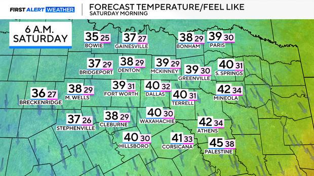
A cold front will push through Friday night, bringing a chill to the air on Saturday morning. Low temperatures fall into the upper 30s and feels-like temperatures for some will dip into the 20s as winds gust up to 30 mph.
The weekend will be dry with highs in the mid-50s, where they should be for this time of year.
Expect highs to return to the lower 60s by Monday. There is no rain in the forecast next week, which is not good for drought conditions as parts of the Metroplex are now in the abnormally dry category on the drought monitor.