Severe storms, hail and tornado threats continue in North Texas through the week

Showers mostly tapered Wednesday evening, and now our focus shifts to the overnight hours, as our cold front lifts back through North Texas as a warm front.
A severe thunderstorm watch is in effect through 8 a.m., including much of North Texas.
Our primary threats where storms do develop will be significant hail, upwards of 2" in diameter or larger.
Strong damaging winds are another threat, and we also have a low-end tornado threat.
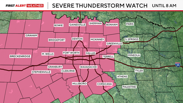
We will have the chance for strong to severe storms during the morning commute, with large hail and damaging wind gusts being the primary threats. We also have an isolated tornado threat.
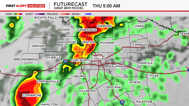
Between 3 a.m. and 9 a.m., storms are forecast to be west of I-35; from 4 a.m. to 10 a.m., storms are forecast to be along I-35 in the Dallas-Fort Worth area and between 6 a.m. and noon, storms are forecast to be east of I-35.
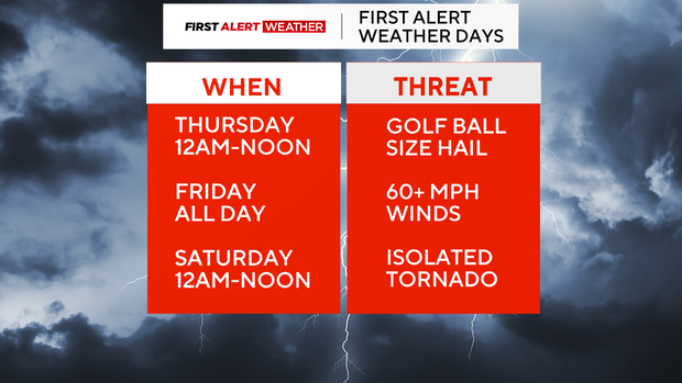
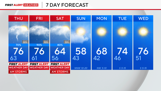
There will be a lull in storm activity Thursday evening. Severe weather with the chance of hail and damaging winds will pick back up against Thursday night into Friday morning.
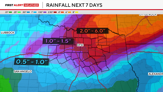
Those threats will hold in place for the next several days, as an area of low pressure moves in, bringing heavier and more widespread rain throughout the day Friday, and into the first half of Saturday.
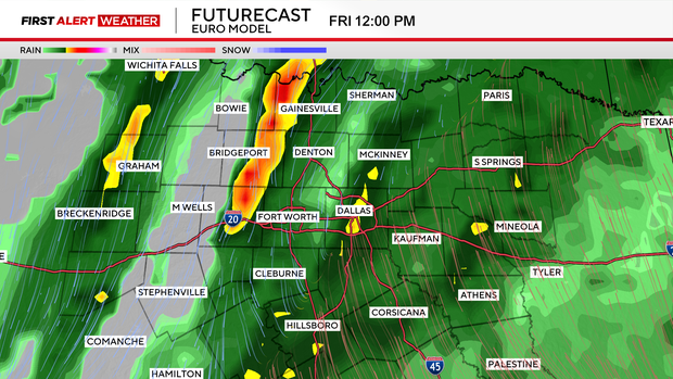
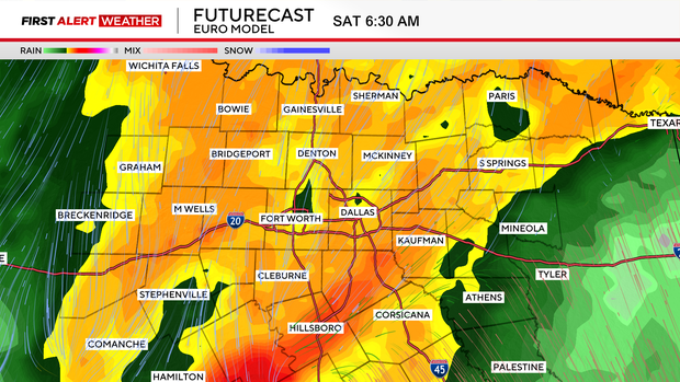
This will bring a threat of flooding to parts of North Texas by the weekend, with some hefty rain totals for parts of the area.
Eventually, a cold front works through this weekend, and drier air starts to filter in by Sunday.
We'll be much colder, however, with highs only reaching the upper 50s for Sunday.