Brief Shot Of Rain & Cooler Temperatures Coming
WARM PATTERN CONTINUES TODAY & TOMORROW
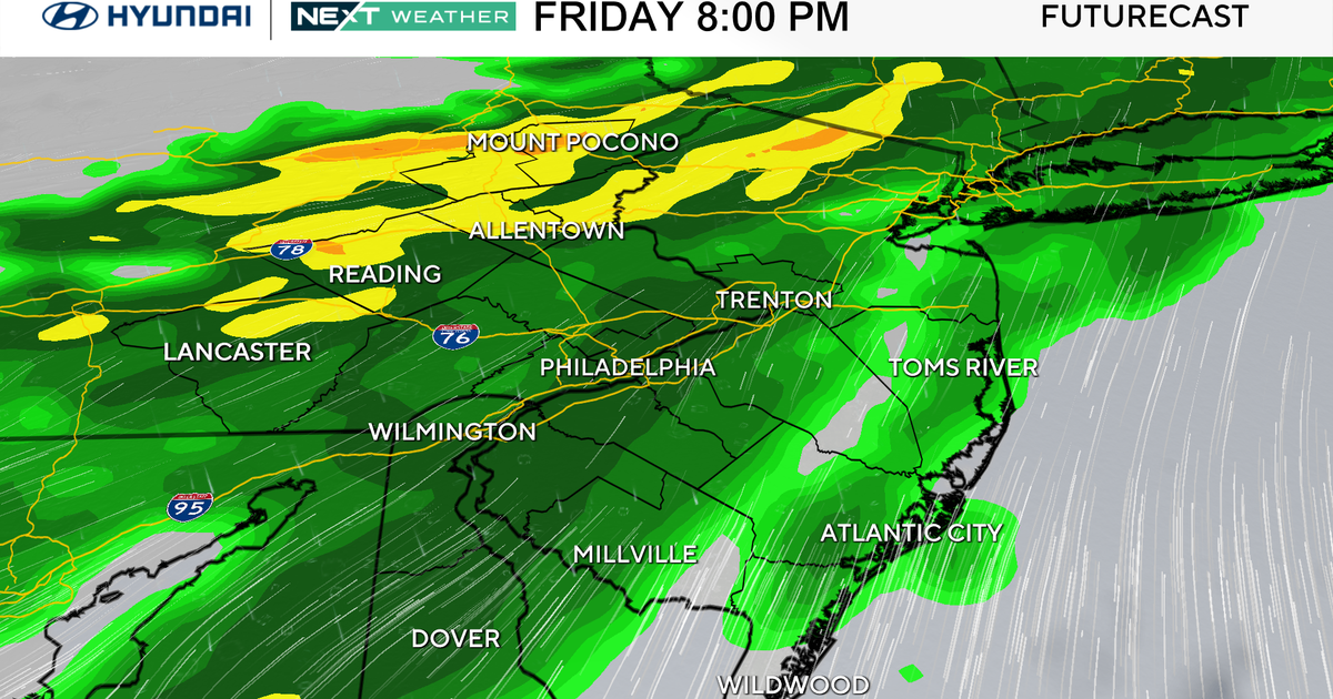
FRIDAY FRONT BRINGS SCATTERED SHOWERS & STORMS
COOLER, WINDY SATURDAY
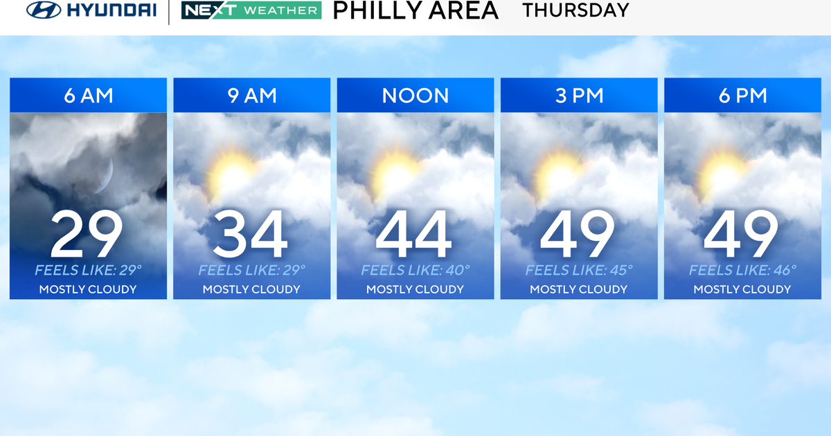
Today & Thursday: sunny with south winds 5-15 today…10-20 tomorrow. Highs 80-83. Winds: S 10-15.
Thursday Night: becoming cloudy with a spot shower or storm possible after midnight as cold front comes in toward sunrise. Rain chance 20 percent. Low 62. Winds: S 10-20.
Friday's change: overall looking less impressive with rain/storm chances. Sticking with a 50 percent chance for rain because all of North Texas stands a chance of seeing it, but it may just be lighter showers for most of North Texas with storm chances east and southeast as front arrives during the midday to afternoon hours. This is where a few storms could become strong to severe. Rain chance 50 percent. High 70. Winds: N 10-20.
Saturday: looking like morning clouds possibly lingering through midday hours. But, the gusty winds will be the big story. North winds 15-25 mph with gusts into the 30s. And all of us who have been to the Main Street Fort Worth Arts Festival before know the wind tunnel effect in downtown. This looks to be the case for at least the first half the day with winds easing by 3pm. Highs may stay in the 60s. High 68. Winds: N 15-25.
Sunday: sunny and beautiful! High 76. Winds: NE 5-15.