Break From 90s Won't Last Long
A string of ten 90 degrees was broken with our latest cold front arriving yesterday and bringing high temps in the middle 80s. Yesterday's high was 84 degrees and today will hit 85. The cool down will be brief. Highs tomorrow push into the low 90s and Sunday will get into the middle 90s. And we'll hang with 90s all of next week.
Our pattern is going to remain active over the next 7 days. At least to the point of the CBS 11 weather team having to watch for small storm chances. This will be a dry weekend and a great weekend to get out and enjoy the pool or lake. That said, we have three key time frames to watch for storm chances.
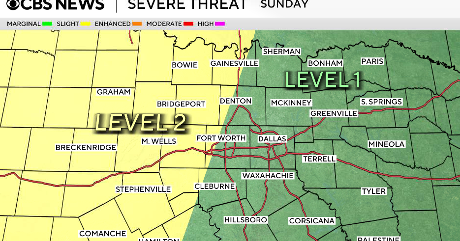
The first two are denoted in the graphic below. Storms will fire in West Texas and Texas Panhandle late this afternoon and have a small chance of holding together into our extreme western portions of North Texas during the evening. This looks to be an extremely outside chance of occurring, but bears watching if you live in Graham, Breckenridge or Jacksboro. Storms will also fire in Oklahoma and drive southeastward toward Bonham and Paris. The timing likely be after midnight. Not anticipating severe weather.
The third time frame is tomorrow morning through the midday hours for the northeastern third of North Texas. Lingering energy plus a northward moving warm front will combine to trigger a 20 percent chance for storms that are not expected to become severe. However, a strong storm or two is possible.
As the front pushes north, we open the door for more 90s for at least the southwestern half of North Texas including the Metroplex. Storms will again generate in Oklahoma tomorrow afternoon, but this time they will migrate eastward into Arkansas as the upper level flow becomes more westerly.

