After Monday storms, near record heat in North Texas Tuesday
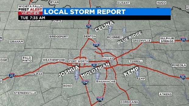
NORTH TEXAS (CBSDFW.COM) - The roller coaster weather ride continues across North Texas. There was a radar confirmed tornado in Johnson County on April 4 and residents in several cities woke up Tuesday to storm damage to their homes and property.
The National Weather Service is planning to conduct surveys in the Collin County cities of Celina and Blue Ridge; the Johnson County city of Joshua, the Ellis County city of Midlothian; and the Kaufman County city of Kemp.
After North Texas' 3rd Monday in a row of severe weather, there is a tranquil remainder of the week ahead.
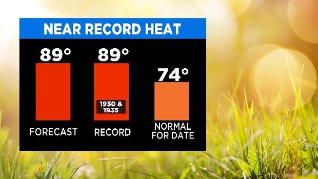
Near record heat is expected today as temperatures soar into the upper 80s and lower 90s thanks to breezy southwesterly winds and dry air west of Interstate-35.
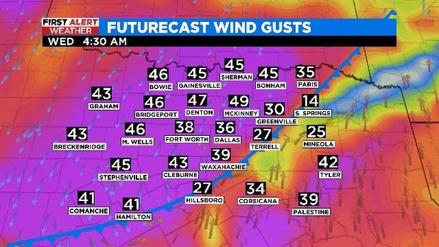
A dry but strong cold front is expected to slide through North Texas overnight, causing winds to shift out of the north and gust between 40-45 mph. A Wind Advisory could be issued later in the day on Tuesday.
Cooler air rides in on those winds, returning North Texas to seasonal highs Wednesday -- in the low 70s.
We finish out the workweek feeling crisp, with morning temperatures in the 40s and afternoons near 70°.