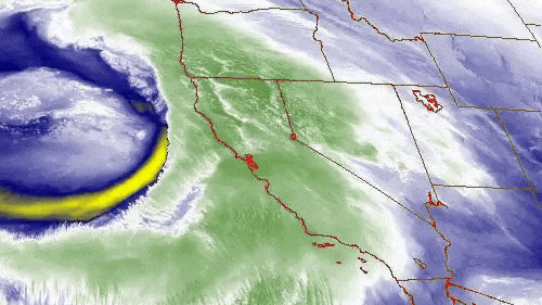
Evacuations, flood warnings issued as Bay Area hit by latest atmospheric river storm
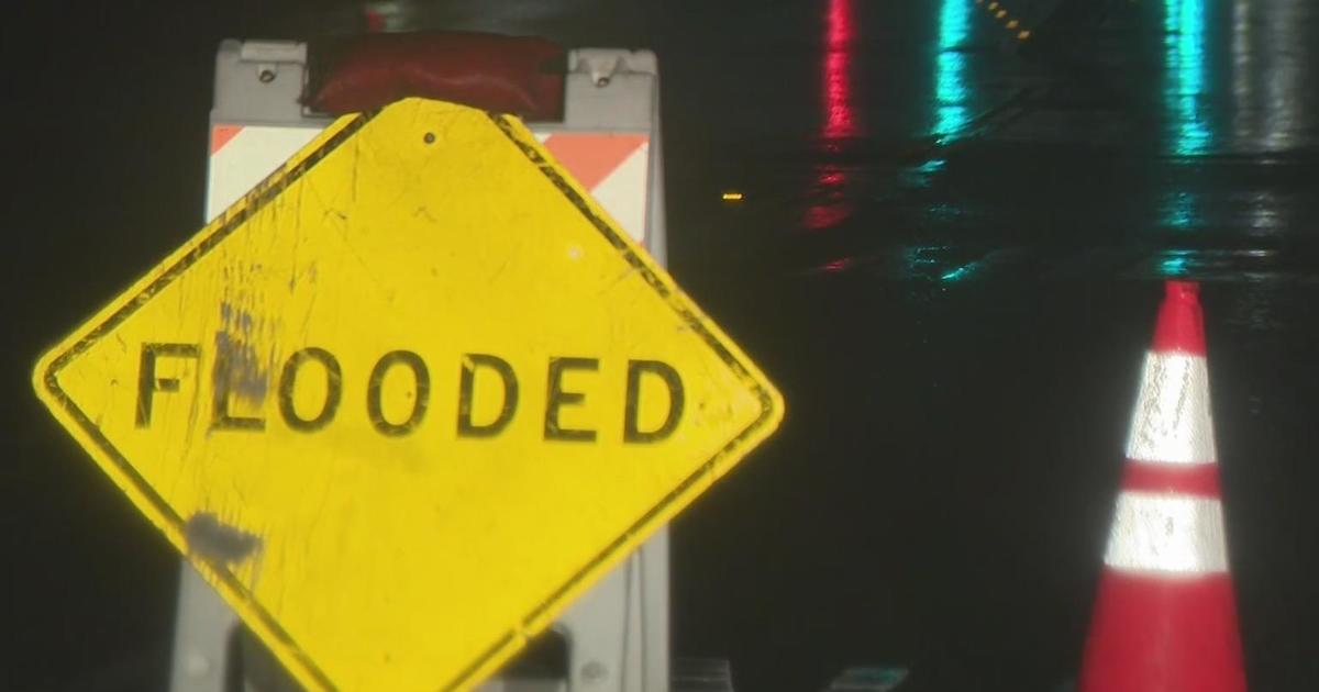
Heavy rain from the latest atmospheric river triggered flood warnings for several Bay Area counties along with some evacuations in Santa Cruz County Thursday.
The National Weather Service issued a flash flood warning for the San Francisco Peninsula, South Bay, and the Santa Cruz Mountains areas, specifically southeastern San Mateo County, west central Santa Clara County, and western Santa Cruz County.
The flash flood warning was in effect until 9:15 a.m. and was replaced by a flood warning in effect until 3 p.m.
KPIX First Alert Weather: Current conditions, alerts, maps for your area
Santa Cruz County evacuations
In Santa Cruz County, the Sheriff's Office evacuated residents in Felton Grove at about 7 a.m. because of likely flooding along the San Lorenzo River, the county said. A temporary evacuation point was set up at Scotts Valley Community Center. Residents in the area had been under an evacuation warning since Wednesday evening.
Deputies posted notices of potential flooding from the San Lorenzo, they also went door to door warning residents to evacuate.
"This is our first winter in the neighborhood, so it's better to be safe than sorry," Jillian, a new resident to Felton Grove, told CBS News Bay Area.
At about 8 a.m. the county said residents in the southern part of the county along Holohan Road and State Route 152 just north of Watsonville were also being evacuated. The Santa Cruz CHP Office said the locations included College Road, Grimmer Road and Lakeview Road areas.
The evacuation orders were lifted at about 2:30 p.m.
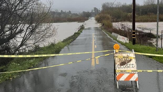
Further north in the community of Interlaken, the California Highway Patrol said Paulsen Road west of E. Lake Avenue/State Route 152 was closed because of flooding.
Officials said other area road closures can be monitored at: https://sccroadclosure.org/
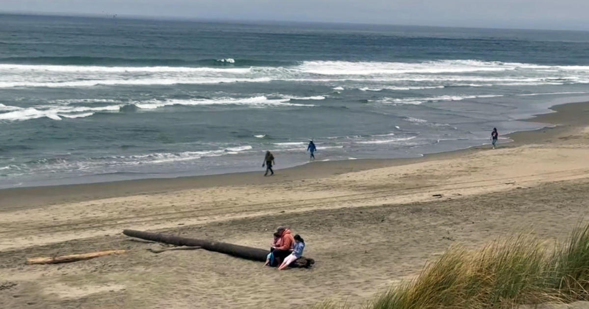
While the earlier evacuation orders had been lifted hours before, the Santa Cruz Sheriff issued a new evacuation warnings at 6 p.m. for some low-lying coastal areas due to high tides and large breaking waves. Those areas of unincorporated Santa Cruz County include Zone CTL-E048, which encompasses the Rio Del Mar and Beach Dr. neighborhood. The warning advised that rising water levels could impact homes and roadways and that residents should "take all necessary precautions and stay alert."
More flood warnings and advisories
Meanwhile, flood warnings were issued in several Bay Area counties that were extended into Thursday afternoon.
In Alameda County, small stream flooding was occurring along the Alameda Creek in the Sunol area because of the excessive rainfall. The Weather Service said flooding in other low-lying and flood-prone locations along the creek was imminent or occurring.
Portions of Sonoma County were also under the flood warning, including the communities of Windsor, Sebastopol, Cotati, Larkfield-Wikiup, Forestville, and Graton. The Weather Service said affected streams include Mark West Creek, Green Valley Creek, Santa Rosa Creek, Laguna de Santa Rosa, and Colgan Creek.
The flood warning also applied to southeastern San Mateo County, west-central Santa Clara County, and western Santa Cruz County.
Most of the Bay Area and the Central Coast were under a flood advisory until Thursday afternoon, with the Weather Service warning of minor flooding in low-lying and poor drainage areas. Small streams and normally dry arroyos will see rising water and ponding of water in urban or other areas is occurring or is imminent, the service said.
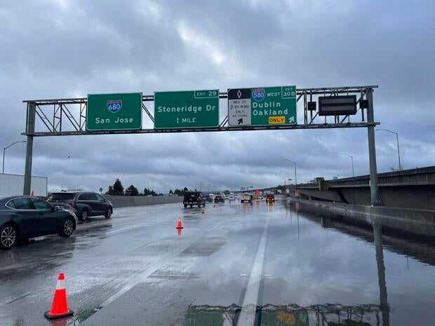
Flooding on Interstate Highway 680 blocked at the I-580 exchange in the Dublin/Pleasanton area blocked traffic Thursday morning. The CHP closed the southbound I-680 ramp to westbound I-580 at around 9 a.m. and said the closure was expected to last up to two hours to clear.
With rain forecast through Friday, most of the Bay Area was also under a flood watch until Saturday evening, and until Sunday evening for the North Bay.
Late Thursday afternoon, the Monterey County Sheriff's Office issued an evacuation warning due to flood risk. The warning was issued in Zones D057-C and D066-B -- affecting areas along the Carmel River near Camp Steffani Rd., Wawona Rd., and Lower Paso Hondo -- Zone C045-B -- affecting areas along Santa Rita Creek in Bolsa Knolls and Salinas, and Zone C040-B, affecting residents living along Ralph Lane in Prunedale. Those needing extra time should consider evacuating now, the warning said. Any resident who feels unsafe should leave immediately and not wait for an evacuation order.
Wind warnings, advisories
Forecasters said moderate to heavy rainfall is expected to continue Thursday afternoon and into the evening, with increasing winds and chances of thunderstorms.
The Weather Service issued a high wind warning for San Francisco and the Peninsula coast, the North Bay coast, Marin County hills and western Sonoma hills, the Santa Cruz Mountains, Monterey Bay and Big Sur Coast.
Winds in those areas were expected to in the 25 to 35 mph range with gusts of up to 60 mph possible, along with isolated gusts of up to 80 mph possible in the higher elevations. The warning was in effect until 10 a.m. Friday.
A wind advisory was also in effect for the East Bay and San Francisco Bay Shoreline, the Santa Clara Valley and Eastern Hills, the North Bay interior mountains and valleys, and the interior Central Coast until 10 a.m. Friday. Winds of 20 to 30 mph and gusts of up to 55 mph are expected. Some isolated gusts up to 60 mph are possible in the higher elevations.
Also along the entire Bay Area coast, a high surf warning will be in effect from 3 p.m. Thursday until 3 a.m. Saturday. The Weather Service said large breaking waves up to 30 feet and peak waves up to 45 feet on west-facing beaches were expected. Beaches not facing west could see up to 20-foot waves and up to 30-foot peak waves.