Rain and snow return to the Northern California forecast this weekend. Here are the big changes coming

After a quiet stretch of weather this week, our weather pattern is about to make a big change just in time for the first weekend of May.
Two more days of warm and sunny weather as we finish the week. This weekend expect cooler and wet weather to return. Our late-season storm system brings more valley rain, colder temperatures and more Sierra snow.
The Change-up
After days of being under an area of high pressure, it'll start to break down as we get closer to Friday, bringing a rapid cool-down to the weekend.
This change opens the storm door and allows our next system to drop down from the Gulf of Alaska.
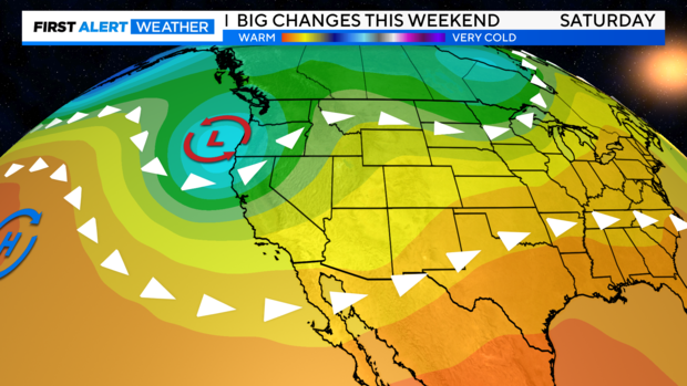
Recent weather models have increased the amount of moisture tied to this system as it taps into a weak atmospheric river. In short, expect more precipitation across Northern California as Saturday turns into a wet day.
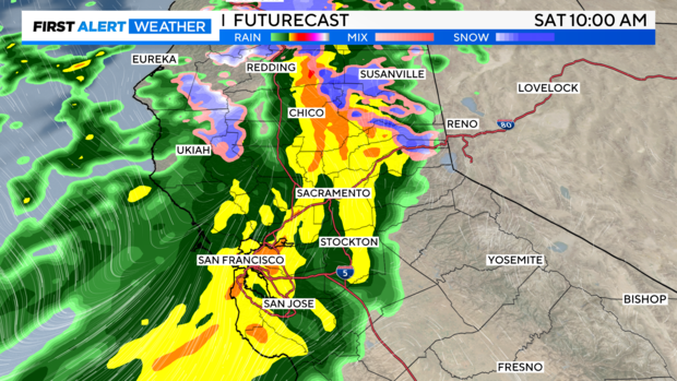
Saturday's Late Season Storm
A cold front is expected to move in from the coast as early as Friday night and while we could see a few showers develop across the northern valley and coastal range, most will stay dry until Saturday morning. CBS13 has made Saturday a First Alert Action Day as the bulk of the system arrives.
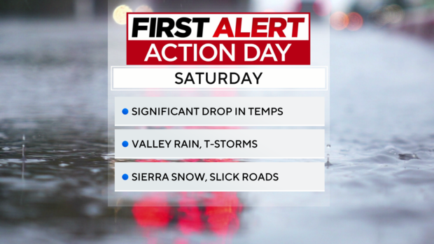
After the initial front moves in expect widespread, steady rain during the morning and afternoon across the valley floor. We could see a few isolated thunderstorms during the afternoon and evening, but those chances are a bit lower with all of the cold air in place. Expect small hail, gusty winds, lightning and brief heavy rain with any thunderstorms that develop.
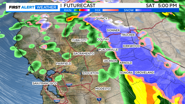
Gusty winds will also develop as this storm moves through on Saturday with the strongest wind across the northern valley, foothills and Sierra. Gusts up to 30 to 40 mph are possible, with gusts up to 50 mph across the Sierra.
Across the Sierra, precipitation will start off as rain at first as snow levels will be quite high, starting around 7,000 feet on Saturday before dropping to 4,000 feet by Sunday morning.
The biggest change of the weekend will be the noticeable drop in temperatures. Highs on Friday will be in the 80s across the valley while highs will only warm to the upper 50s through the weekend, about a 20 to 30 degree drop for most.
Being two days away, there is still the chance of precipitation amounts to change depending on the track of this system. If the bulk of this system stays to the north, this would lead to much lower rain and snow totals. Something we'll keep an eye on for the next 48 hours. Yet as of Thursday morning, amounts have increased.
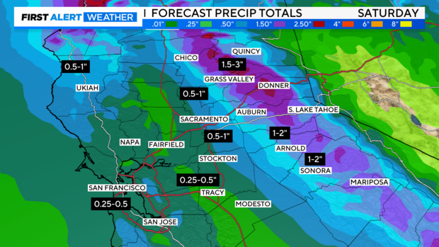
In our current forecast expect amounts of 0.50'' to 1'' across the valley, 1'' to 2'' in the foothills and 1.5'' to 3'' across the Sierra from Friday night through Sunday morning. This will be a beneficial rain for most as we head into the warmer months of the year.
This will be significant by May standards locally as Sacramento's average monthly precipitation for the month is 0.86''.
Winter Storm Warning
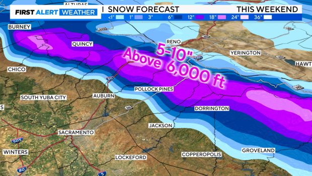
As for snow, the highest accumulations will be in areas above 6,000 feet. From 6,000 feet and higher, we are forecasting 5 to 10 inches of snow with up to a foot at higher peaks.
A Winter Storm Warning and Winter Weather Advisory have been issued from 11 a.m. Saturday to 8 a.m. Sunday. Travel will be difficult with heavy snow and wind gusts greater than 60 mph at times.
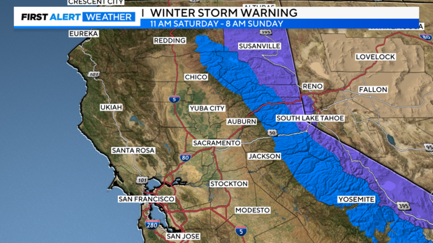
Minor accumulation below 5,000 feet but enough to make roads wet and slick. Make sure to stay updated with the forecast before you travel over the passes as we could see possible travel delays.
This will be a fast-moving storm system and will quickly clear out of the region by Sunday morning. We may see a few lingering showers across portions of the Sierra, but these showers should not amount to much accumulation.
Sunday and Beyond
Once our storm system passes, Sunday will turn into a nice day from the foothills to the coast with partly cloudy skies overhead. Cool air will be in place, but highs will be slightly higher than Saturday's with many in the upper 60s.
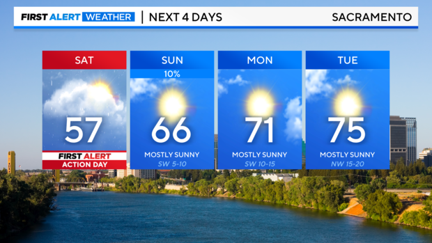
Temperatures will be slow to warm looking ahead to next week starting off cooler than average before reaching back to the low 80s by Wednesday.
Across the valley, next week looks to stay mainly dry with more wind returning throughout the week. We could see a few light showers across the Sierra, but many will end up dry.
Make sure to stay with the CBS Sacramento First Alert Weather team for updates on this weekend's storm and changes to next week's forecast.