Memorial Day weekend brings a slight cool-down to Northern California

It's been a beautiful stretch of weather this week. Highs have been slightly warmer than average with plenty of sunshine overhead.
As we get closer to the holiday weekend, our weather pattern is about to make a slight shift to help temperatures dip across Northern California.
Through Thursday, we'll start to notice a few changes with afternoon highs slightly cooler than the beginning of the week and the return of the Delta Breeze in the evening.
The slight cool-down
At the beginning of the week, an area of high pressure kept us warm and dry. This ridge will begin to shift towards the west through the day on Thursday allowing for the return of an onshore flow and Delta Breezes by the evening. West winds up to 25 MPH will be possible across the Valley, as our natural air conditioner kicks in.
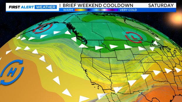
Several weak storm systems will pass through the Pacific Northwest Friday and Saturday bringing more wet weather to the north, but helping to cool afternoon temperatures off across Northern California.
We'll stay mainly dry across the region, with more cloud cover by Friday and the chance of a few isolated showers and thunderstorms across the Sierra to end the week and start the weekend.
This will be a short-lived cool down as high pressure begins to rebuild by Sunday, bringing more sunshine and warmer temperatures on Sunday and Memorial Day.
The holiday forecast
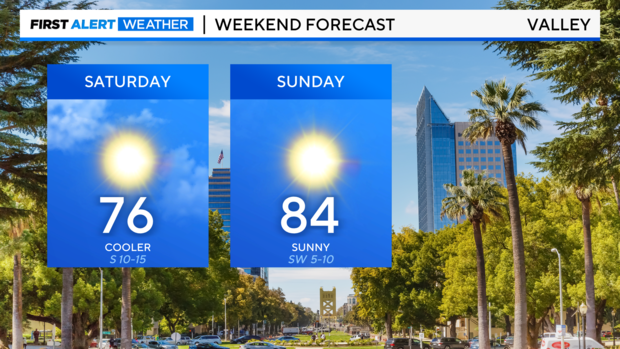
A cool, yet sunny start cooler start to the weekend as highs reach for the upper 70s across the Valley on Friday and Saturday. Saturday will be the coolest day of the week before we warm back up by Sunday. There will be a few light breezes around this weekend.
Whether you are in Stockton, Yuba City, or anywhere in between, Saturday and Sunday will be beautiful days to get outside.
The Sierra and foothills will offer a mix of conditions over the weekend. Friday and Saturday will bring mostly cloudy skies for the first part of the day, with some afternoon clearing. By the afternoon, highs reach the low 60s on Saturday and upper 60s on Sunday in Tahoe. There will be the chance of a few pop-up showers and thunderstorms on Friday and Saturday, yet many will stay dry.
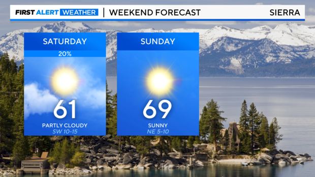
Just keep an eye out and an umbrella around in case you get caught underneath a quick passing shower or storm. The best chances for Sierra storms this weekend will be south of HWY 50.
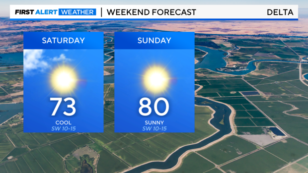
Across the Delta, expect a nice, sunny weekend. A few passing clouds to start the weekend before plenty of sun through the afternoon. Highs warm to the low 70s Saturday and low 80s by Sunday.
By Memorial Day, highs warm across the region. From the Bay Area to the Sierra. Monday will be a great day to get outside.
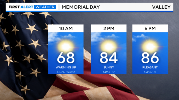
Across the Valley, temperatures warm through Monday afternoon. Many reach the low 80s by 1 P.M. Upper 80s return by the early evening.
What's ahead next week
Through next week expect more sunshine and another slight warm-up.
Highs hold to the upper 80s and low 90s through the week across the Valley. We'll continue to hold onto our cool Delta Breezes through most of the week.
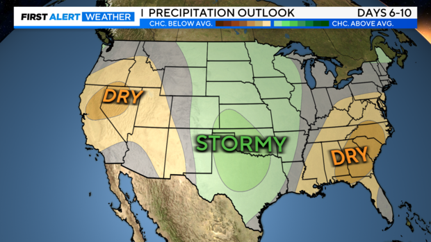
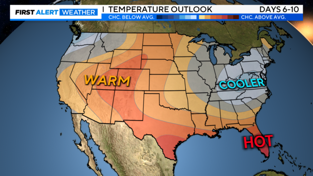
A generally quiet pattern from the next 6-10 days. Make sure to stay with the CBS Sacramento First Alert Weather team for any changes.