Widespread rain and storms expected all weekend across Pittsburgh area; flood watches issued
A flood watch is in effect until Sunday morning for almost our entire KDKA-TV viewing area, except the Laurel Highlands and areas north of I-80.
First Alert: Tonight (Isolated severe storm potential; flooding possible, flood watch in effect)
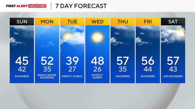
Aware: More rain early Sunday but ending by the afternoon.
Climate: Average High: 58 | Average Low: 37
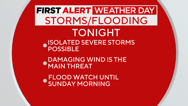
Excessive runoff may result in flooding of rivers, creeks, streams, and other low-lying and flood-prone locations. Creeks and streams may rise out of their banks.
Area creeks and streams are running high and could flood with more heavy rain. An additional 1.0 to 1.5 inches of rain is possible through early Sunday, with locally higher totals possible.
With the ground already saturated from recent rain, the potential for flooding may increase.
Widespread heavy rain and thunderstorms will continue tonight into Sunday morning as a slow-moving cold front moves across the region. There may be a break in the rainfall by late morning into early afternoon Sunday, but rain will return Sunday night before the system finally exits east on Monday.
Temperatures will be cooler to start the week, with a chance for a few rain/snow showers Monday and Tuesday. We warm back up to the upper 50s to finish the week.