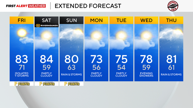
Pittsburgh will get a break from the heat on Friday afternoon, with mostly pleasant weekend weather

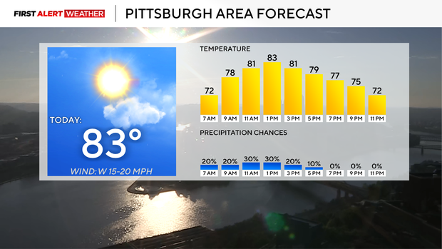
Relief from humidity is expected to come this afternoon on the heels of a cool front that will slide through. While the front comes through, some rain and even an isolated storm should be expected.
Most model data show very little in the way of storm activity due to limited instability to punch through the stable air that acts as a lid. The cold front will still act as a trigger for rain and storms to fire off.
The highest chance for rain will come from 11 a.m. through 3 p.m.
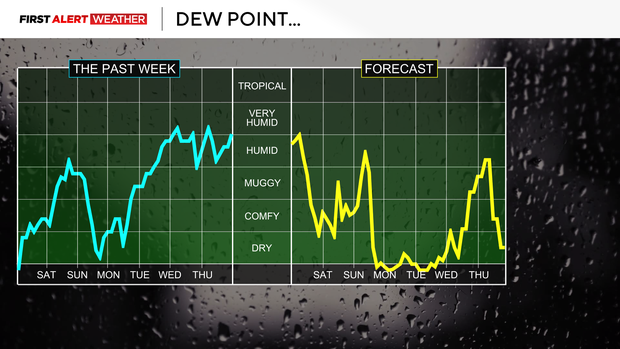
The difference in what you can expect it to feel like after the front moves through, compared to what it feels like ahead of the front, will be drastic. Dew points are hovering near 70 degrees this morning. That's more in line with what you would expect to see this time of the year in places like New Orleans and Orlando.
By 4 p.m., dew points, a measure of moisture at the surface, will have fallen to around 60°. Dew points will fall to near 50° on Saturday with sunny skies and highs remaining in the 80s. Saturday will be fantastic for getting outside to maybe walk the dogs, go to a festival, or just do some yard work.
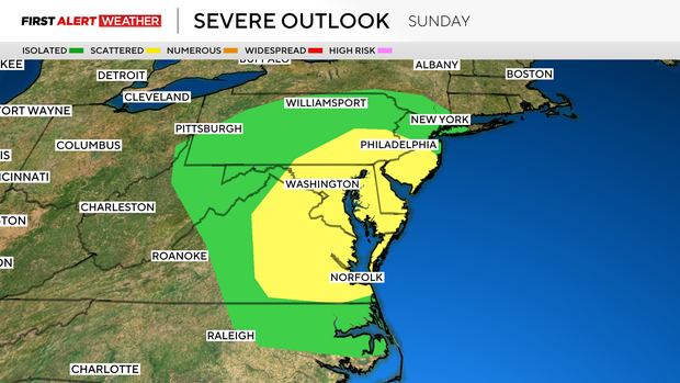
Storm chances are set to return on Sunday, with both rain and storms arriving in the morning hours just after sunrise. Off and on rain and storms will continue through at least 4 in the afternoon and maybe even longer than that. Sunday highs will hit the low 80s.
Moving into the next work week, expect a stretch of days with highs in just the 70s Monday through Wednesday. Even Thursday and Friday highs won't be very warm, with highs both days expected to be in the low 80s. The highest rain chance for the week comes on Sunday and Thursday.