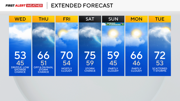
Low, but persistent rain chances remain in the Pittsburgh area on Wednesday
Rain chances will be low today, but the chance for rain will pick up heading into the overnight hours, with two to three bursts of rain and storms expected for Thursday.
The first one arrives after 10 this evening and will bring rain, and some storm rumbles to our area.
Right now, it looks like most of the morning commute will be dry with the next round or two of rain arriving around noon on Thursday and sticking around through about seven in the evening. Severe weather is not expected on Thursday, but it can't be ruled out, as each one of the chances for rain will be moving fairly quickly.
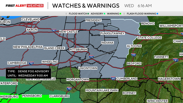
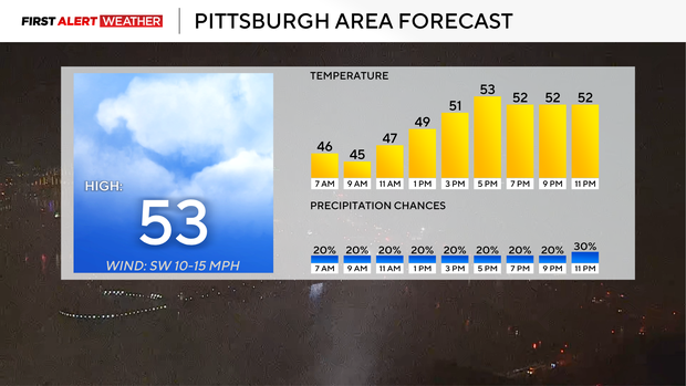
Today will be a lot less busy when it comes to rain, but we do have a fog advisory posted through 11 a.m.
The rest of the day will still be cloudy with highs in the mid to low 50s. Morning temperatures are in the 40s. Winds today will be light and variable. Winds will start out of the north and will finish out of the southeast.
They'll be light all day long.
Looking ahead, highs are set to soar to the 70s on both Friday and Saturday. If we hit the 70-degree mark, it'll be the first time this year for that and the warmest since October 19th of last year, when we hit 75°.
I have Friday's high now at 70 degrees, with the record high for the day standing at 74°. Saturday's record high is 76°, and I am now forecasting a high temperature of 75°.
It'll be close.