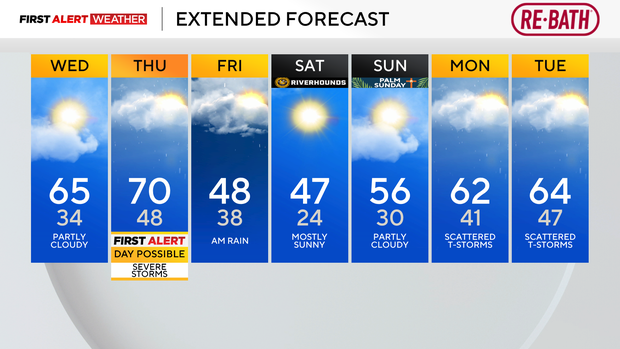
Warmer weather moves into Pittsburgh on Wednesday with storm chances possible this week
Highs today will soar to the mid-60s with morning temperatures in the mid-30s. It's just another snippet of spring weather before our next brief cooldown arrives on Friday.
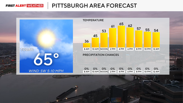
Today is looking dry, but there will be plenty of clouds moving through. I have our skies as partly cloudy, but that's really the best-case scenario. I have noon temperatures in the mid to low 50s with highs near 4 p.m. Temperatures will really go up quickly this afternoon.
One of the reasons for that is the warm front that has passed us by in the morning hours. Radar actually showed some light drizzle along the warmth's leading edge. Overnight temperatures really just held steady as the warmer air slid in.
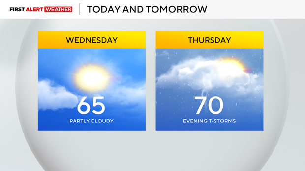
The warmth won't stick around for long with another warm day expected on Thursday and a cold front sliding through around midnight on Friday. It's actually ahead of the front where our severe weather chances will peak, with everything on the table, including tornadoes.
At this point, the window for the nastiest weather is narrow, coming in the late afternoon hours. This would be well ahead of the cold front that wouldn't move through until Friday morning. Singular cells could begin to rotate due to high levels of shear. Looking at sounding analogs (basically looking at past data and comparing it with what models are showing on Thursday), there is a loose relationship with expected conditions and tornadoes on Thursday afternoon.
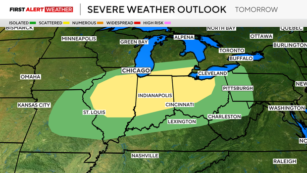
Model data is starting to show more storms developing at the time of the biggest concern. The question at this time is how long the environment for supercell development will last and whether we will see a supercell forming and sliding through. If we do see singular cells well ahead of the main line of storms forming, that will be where our biggest concern will be.
Besides that, we cool down on Friday with light rain along and south of I-70. I have highs in the 40s on Friday and Saturday, but highs back in the 50s on Sunday.
Rain and a few storms look to be possible on both Monday and Tuesday of next week.